Mali is a country you cross in stages — a dusty capital, a slow brown river, a wall of ochre cliffs, and mud mosques that have stood for six centuries. This seven-day route threads them together by plane, road and pinasse, from the Niger's bend to the edge of the Sahara.
Day 1–2: Landing in Bamako and Learning the Capital's Rhythm
Almost every Mali itinerary begins at Modibo Keïta Sénou International Airport, about 15 km south-west of central Bamako. Long-haul flights rarely come direct; most travellers connect through a North African, Gulf or West African hub and arrive in the small hours, when the taxi touts are loudest. Build in a full day of slack before heading north — flight timings into Bamako shift constantly, and a missed connection can cost you two days of a one-week trip.
Use your first day to acclimatise on the city's red-earth streets. The National Museum of Mali, near the river in the ACI 2000 district, holds one of West Africa's strongest collections of masks, bogolan mud-cloth and terracotta figures from the Niger valley — a useful primer before you see the real villages. Close by, the Marché Rose (actually painted a faded terracotta) is the place to buy woven blankets and shea butter, while the Grand Mosque of Bamako in Bamako Coura anchors the old commercial quarter.
On day two, climb Point G for a view over the city and the river plain, visit the Muso Kunda women's museum if it is open, and spend the late afternoon at a maquis — a roadside grill — eating grilled capitaine fish with rice and peanut sauce. Get your CFA francs before you leave; ATMs thin out dramatically once you head beyond Ségou.
Day 3: Ségou, the Balani Quarter and the Pottery Fires of Kalabougou
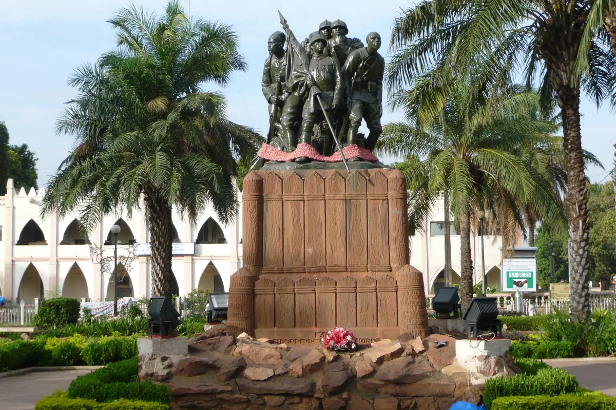
Ségou sits roughly 240 km north-east of Bamako, a two-and-a-half to three-hour drive on a paved road, or a short domestic hop if a seat is available on the day. Once the capital of the Bambara kingdom, its old riverside quarter, Ségou Koro, is a maze of low mud-brick houses, colonial-era warehouses and the tomb of Biton Mamary Coulibaly, the eighteenth-century ruler who made the town a power on the Niger.
The set piece is across the water. Kalabougou is a potters' village on the far bank, and every Saturday night its women stack hundreds of hand-coiled vessels into a single open-air bonfire; by dawn on Sunday the glow has died and the pots are pulled out glowing and smoked. A pinasse ferry across the Niger takes about twenty minutes, and it is worth timing your Ségou night to catch it.
Ségou's Musée du Sahel, housed in a former colonial building, gives context on the region's textiles and its role in the river trade. Sleep riverside, where the breeze actually reaches you — daytime temperatures here run past 40°C from March to May, and only the November-to-February window offers genuinely cool, dry nights.
Days 4–5: Djenné's Great Mosque and Mopti, the Venice of Mali
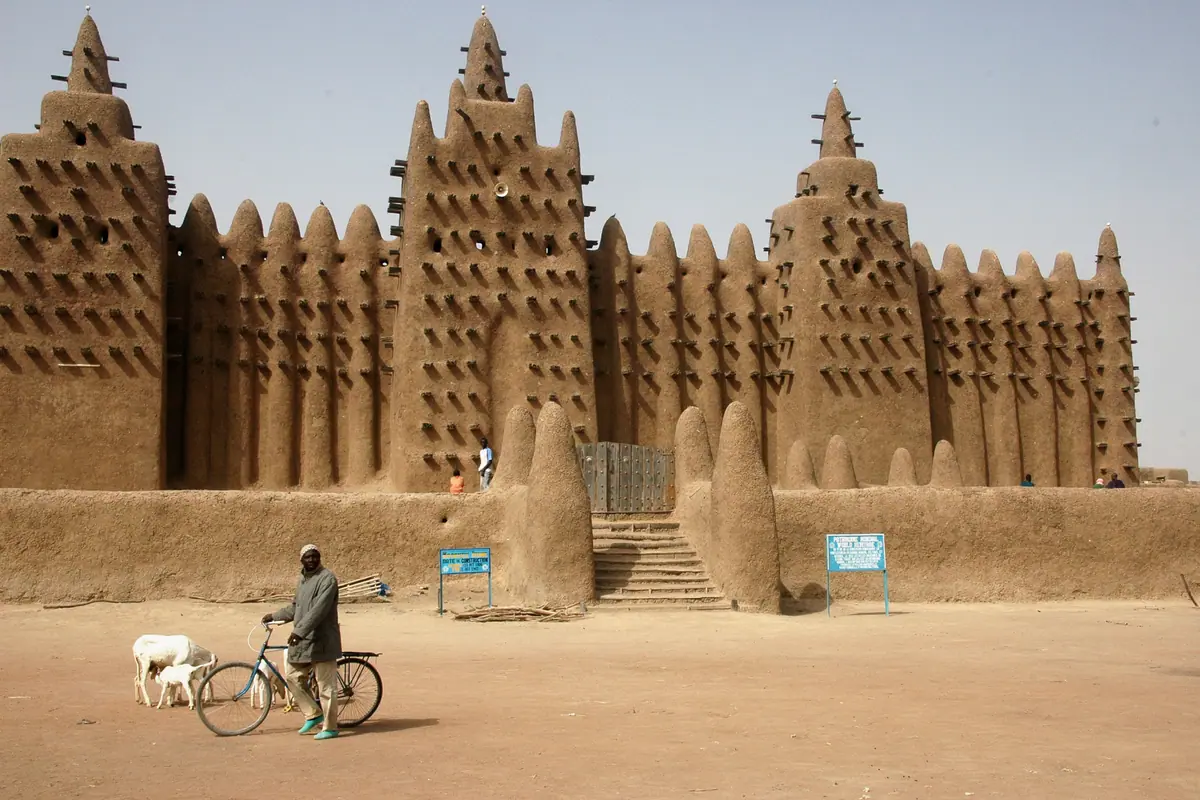
Push on east to Djenné, a UNESCO-listed town of mud architecture that many travellers rate as the single most beautiful place in West Africa. Its Great Mosque is the largest mud-brick building on earth, a bristling forest of toron — the wooden beams that protrude from its walls and double as scaffolding for the annual crépissage, when the whole community re-plasters the surface by hand. Non-Muslims may not enter the prayer hall, but the exterior at first light, with the Monday market spreading across the square in front of it, is the memory people keep.
Walk ten minutes out of town to Djenné-Djenno, a low archaeological mound that was a thriving trading city more than two thousand years ago, and thread the narrow lanes of the old town where every door and window frame is carved and studded. Two nights here is ideal; one feels rushed given the road time.
From Djenné it is a short, hot drive south to Mopti, the country's river hub, where the Niger meets the Bani. Mopti's Grand Mosque stands above a busy port of colourful wooden pinasses loading salt, millet and dried fish. Hire a boat for a few hours along the water, and use the town as your springboard for the cliffs.
Days 5–6: The Bandiagara Escarpment and the Villages of Dogon Country
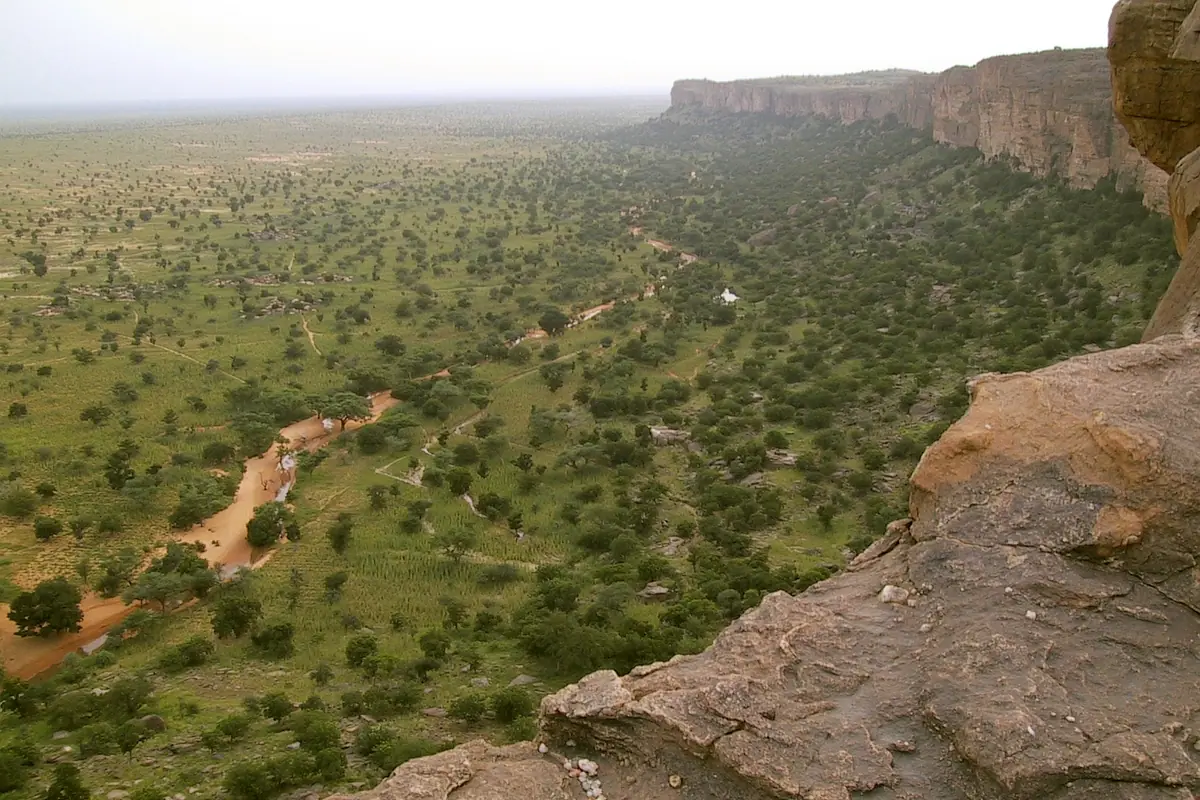
The drive from Mopti to Bandiagara climbs onto the plateau that faces the Bandiagara Escarpment, a 150 km sandstone wall where Dogon villages cling to the rock. This is the section most visitors come for, and it deserves at least two nights. Base yourself in Bandiagara or, better, drop down into a village such as Sangha, Ireli or Kani Kombole and walk between settlements.
A local guide is not optional — it is expected by the communities and essential for reading the landscape. You will see the toloy and telem cliff niches where earlier peoples buried their dead, the men's meeting houses with their carved posts, granaries capped in thatch, and the flat-roofed mud mosques of villages like Kani Kombole, which has been quietly re-plastered for centuries. Distances between villages are short but the paths are rough and unshaded; plan on two to four hours of walking a day and carry water for all of it.
October to February is the comfortable window, when the harmattan haze is light and nights are cool on the plateau. Mask dances are not staged to order; they follow the farming calendar, so ask your guide honestly rather than arriving with expectations. Roads in the region have improved but security conditions change — check your government's current advisory before committing and travel with a trusted local operator.
Day 7: Timbuktu, the City of 333 Saints — If Access Allows
Timbuktu is the name that drew you here, and it remains the emotional endpoint of Mali. Its three great mud mosques — Djinguereber, Sankore and Sidi Yahya — define a skyline that was once the intellectual capital of the Islamic world, drawing scholars from Cairo and Córdoba. The Ahmed Baba Institute holds manuscripts that survived both fire and looting, and the Flame of Peace monument on the desert edge marks the 1996 burning of weapons after the Tuareg rebellion.
Getting there, however, is the hard part. Timbuktu sits on the edge of the Sahara about 900 km north-east of Bamako, and scheduled air service into its small airport from Bamako and Mopti is intermittent at best — sometimes running, sometimes suspended, with little notice. The alternative is a punishing two-day road journey or the slow river boat from Mopti, which only runs when water levels allow, roughly August to December.
Be realistic and be careful: large parts of northern and central Mali are under sustained travel warnings, and most embassies advise against all travel to the Timbuktu region. Many travellers now satisfy the dream by flying to Mopti for the Dogon cliffs instead, or by staying in Bamako and reading up on the manuscript tradition. If the security picture improves and you do go, plan it at the end of your week so a cancelled flight cannot wreck the rest of the trip.
Flights, Seasons and Safari-Style Logistics for a One-Week Trip
Mali's domestic aviation is thin. Aside from the international gateway at Bamako, a handful of operators run occasional services to Mopti and Kayes, and seats sell out early and cancel often. Treat any internal flight as a bonus rather than a plan: build your itinerary so the road-and-river option still works, and book flexible fares wherever you can. Baggage allowances on the small aircraft that serve the interior are tight, usually around 15 kg.
Timing matters more than almost anywhere. November through February is the dry, cool, dusty season and by far the best window — expect hazy skies from the harmattan and cool nights in the Sahel. March to May is brutally hot, with Bamako and Ségou frequently above 40°C. The rains arrive June to September, greening the Dogon plateau but turning dirt roads to soup and shrinking the river boats' timetable.
Practicalities: carry a yellow-fever certificate, take antimalarials, and drink only filtered or bottled water. French and Bambara will carry you further than English. Cash is king outside the capital — the CFA franc is the currency, and small notes are far more useful than large ones. Most visitors find a week covers Bamako, Ségou and either Djenné-Mopti or the Dogon cliffs comfortably, but not both plus Timbuktu.
Frequently asked questions
How do I get between Bamako, Mopti and Timbuktu?
Bamako is the international gateway. From there, Ségou, Djenné and Mopti are reachable by paved road in a day or less. Flights to Mopti run irregularly, and services to Timbuktu are intermittent and often suspended — check current schedules and advisories rather than assuming a seat exists.
What is the best time of year for a one-week Mali itinerary?
November to February. Skies are dry, the harmattan haze is manageable, and nights in Dogon Country are cool. March to May is punishingly hot, while June to September brings rain, muddy tracks and a shortened river-boat season.
Is Timbuktu safe to visit?
Most governments currently advise against all travel to the Timbuktu region and much of northern and central Mali. Conditions change, so check your own country's latest advisory and speak to a reputable local operator before considering it. Many travellers substitute Mopti and the Dogon villages.
How much time do I need for Djenné and Dogon Country?
Give Djenné one night, ideally two so you catch the Monday market and the mosque at dawn. The Bandiagara Escarpment deserves at least two nights, with two to four hours of walking a day between villages. Trying to squeeze both into a single week alongside Bamako and Ségou is tight.
What should I pack for Mali?
Light long sleeves and trousers for sun and mosque etiquette, a wide-brimmed hat, sturdy closed shoes for rocky Dogon paths, a head torch, water purification, antimalarials, and a yellow-fever certificate. Bring cash in CFA francs and modest clothing that covers shoulders and knees.
Sort the rest of your trip
Everything for Mali, in one place

More guides in Mali
Best Time to Visit Mali: Seasons, Hotels and Must-See Sights
Mali Travel Guide: Food, Culture and Local Experiences from Bamako to Timbuktu
Where to Stay in Mali: Hotels and Must-See Places from Bamako to Timbuktu
Best Places to Visit in Mali: Timbuktu, Djenné and the Bandiagara Escarpment