Eritrea rewards the curious traveller with a capital of futurist 1930s architecture perched on a cool highland plateau, a sweltering Red Sea port of coral-block alleys, and a scatter of ancient Aksumite ruins that almost no outsiders ever see. Travel here is slow, permits are part of the ritual, and the pay-off is a country that feels genuinely untouched by the tourist trail.
Asmara: A Modernist Capital on a Highland Plateau
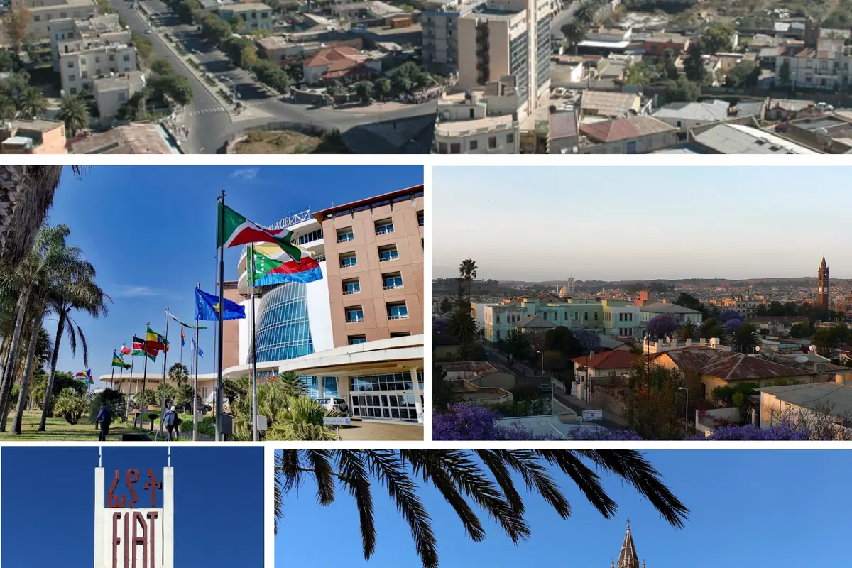
Asmara sits at about 2,330 metres, where the air is thin, the light is sharp and the evenings are cool enough for a jacket. Take your first day gently if you have flown in from sea level. The city was laid out on a grand scale in the 1930s, and its centre is an open-air museum of that era, so distinctive that the whole historic core has been recognised as a World Heritage site. Liberation Avenue, known locally as Harnet Avenue, runs arrow-straight beneath palms and jacaranda, lined with cafes where you can order a macchiato and watch the city drift past on foot.
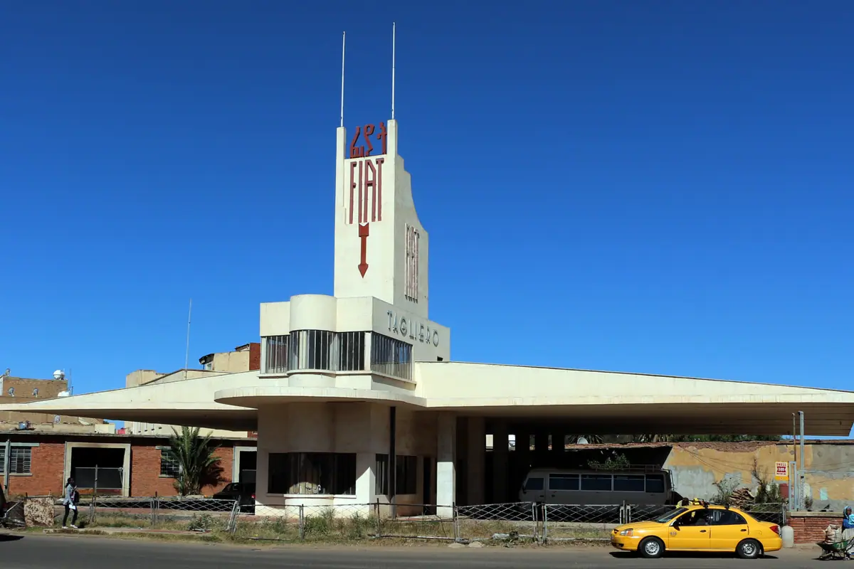
The buildings are the reason to linger. The Fiat Tagliero Building is the showstopper: a 1938 service station shaped like a soaring aircraft, its two concrete wings cantilevered over the forecourt with nothing visibly holding them up. Nearby, Cinema Impero and Cinema Roma still carry their original Art Deco curves and lettering, and the surrounding blocks deliver one surprise after another - rounded balconies, porthole windows, aerodynamic shopfronts, Futurist flourishes that look startlingly modern for their age.
Then there is the layered faith of the place: the twin-towered Enda Mariam Orthodox Cathedral, the Gothic-arched St Joseph's Catholic Cathedral and the Al Khulafa Al Rashedin Mosque, all within a short stroll of one another. Push into the Medebar market for sacks of berbere and incense, woven baskets and coffee roasted in front of you - the smell of green beans hitting a hot pan is worth the walk alone.
Down the Escarpment: The Road and Railway to the Sea
The 118-kilometre descent from Asmara to Massawa is one of the great road journeys of the Horn of Africa. In a few hours you drop from cool highland pastures to a shoreline that shimmers at 40C, crossing more than 30 tunnels, a string of viaducts and a tight ribbon of switchbacks cut into the escarpment in the 1930s. Watch the verges for troops of hamadryas baboons and the sky for ravens riding the thermals below you.
That same escarpment carries the old Eritrean railway, a feat of mountain engineering with gradients so steep that ordinary locomotives could not manage them unaided. Scheduled services are long gone, but heritage steam charters still run the most dramatic stretch from Asmara down to Nefasit on selected dates, and the sight of an antique locomotive wheeling through the hairpins is the classic Eritrean photograph. Halfway down, Nefasit is also the trailhead for the Debre Bizen monastery, a cliff-top community founded in the 14th century and reached by a three-to-four hour uphill hike; it is traditionally open only to men, so ask before setting out.
Massawa and the Dahlak Archipelago
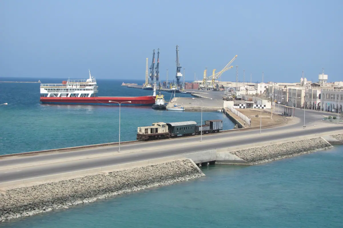
Massawa is a world away from the capital: a low, coral-built port spread over a pair of islands, where the heat sits on your shoulders and the sea is a flat sheet of turquoise. Ottomans, Egyptians, Italians, British and Ethiopians have all fought over it, and the old town still shows those layers in crumbling coral-rag walls, shuttered arcades and minarets. Time your visit between November and March, when the coast is merely hot rather than brutal.
Start at the Sheikh Hanafi Mosque, a 15th-century prayer hall with a carved wooden ceiling, then wander past the old Naib's residence and the Palace of Emperor Yohannes IV. From the harbour, boats run out to the Dahlak Archipelago, a chain of more than a hundred islands scattered across the Red Sea. Dahlak Kebir, the largest, hides ancient Kufic inscriptions, while the reefs around Green Island and Dissei offer some of the least-visited diving in the region - coral gardens, clouds of reef fish and the odd wartime wreck, with hardly another boat in sight.
Keren, Nakfa and the Northern Highlands
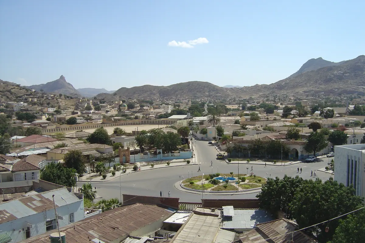
Keren, the third city, lies about 91 kilometres northwest of Asmara in a bowl of granite boulders at roughly 1,390 metres. Its Monday livestock market is one of the most photogenic sights in the country: hundreds of camels, cattle, goats and sheep, traders down from the lowlands, and a hubbub of bartering that starts at dawn and fades by midday. Bring small change, ask before photographing people, and expect temperatures well above the capital's.
Above the town, an ancient baobab tree cradles the Mariam Dearit shrine, a chapel fitted into the hollow trunk and reached by a short climb with wide views over the valley. Lower down, the war cemetery and the ridges around Keren recall the hard-fought 1941 battle that shaped the region's history. Push further north and the landscape empties out completely on the climb to Nakfa, the mountain town at around 1,600 metres that was the heart of the independence struggle. Its hillsides are still laced with trenches, and the murals, small museum and martyrs' cemetery make it one of the most affecting places in Eritrea.
The Aksumite Trail: Qohaito, Adulis and Matara
Eritrea's highlands hold the northern edge of the ancient Aksumite world, and the ruins are gloriously uncrowded. Qohaito, on a 2,600-metre plateau near Adi Keyh, was a thriving trading town on the road down to the Red Sea; today you can walk among the foundations of temples and houses, trace the old dam walls and find rock art in the surrounding cliffs. The views across the plateau are half the reason to come, and you will most likely have the entire site to yourself.
Near the coast at Zula, Adulis was the great port that fed the Aksumite empire, shipping ivory, gold and spices across the sea; its ruins lie on a hot, flat plain where the wind never stops. Further south, close to the town of Senafe, the Matara site - also called Belew Kelew - preserves the Hawulti obelisk, carved with an ancient Ge'ez inscription, along with the remains of a substantial town. Both places are remote, both need a permit and a sturdy vehicle, and both reward anyone willing to make the dusty journey.
Cloud Forest, Salt Flats and the Far Coasts
Not all of Eritrea is semi-desert. On the eastern escarpment between Nefasit and Elabered, the Semienawi Bahri - the Filfil-Solomuna forest - is a green belt of cloud forest and juniper dropping from about 2,400 metres towards the coastal plain. It is the country's best birdwatching, with hornbills, barbets, sunbirds and raptors, plus vervet monkeys and baboons, all easiest to spot in the early morning when the road is green on both sides.
North and east of the highlands, the land falls away into the Danakil, one of the hottest and lowest places on earth. Eritrea's slice of it takes in the Buri Peninsula, shining salt flats where camel caravans still load slabs of salt, and Afar settlements scattered along the shore. This is expedition territory: you need permission, a guide, a robust 4x4 and plenty of water, and it is only sensible between November and February, when coastal nights are just about bearable. Continue south and the Red Sea coast runs down towards Assab, another remote, barely dived stretch of reef and volcanic shoreline.
Frequently asked questions
When is the best time to visit Eritrea?
October to March is the sweet spot. Asmara stays mild year-round, roughly 15-25C, but the highland rains fall from June to September, so dry-season roads are far easier. The Red Sea coast around Massawa is best from November to March, and the Danakil lowlands are only realistic in the cooler winter months.
Do I need a permit to travel outside Asmara?
Yes. Foreign visitors generally need a travel permit for anywhere beyond the capital, arranged in Asmara a few days in advance, usually with the help of a local host or guide. Trips to the Dahlak Archipelago, the Danakil and the far south require additional permission, so build some flexibility into your itinerary.
How do I get around the country?
Asmara to Massawa and Asmara to Keren are on paved roads, and shared minibuses and taxis handle short hops. For longer circuits, hiring a car with a driver is the usual approach. Heritage steam trains run only on selected dates and domestic flights are limited, so land travel and patience are part of the deal.
How much time do I need in Eritrea?
A week covers Asmara, the escarpment, Massawa and Keren comfortably. Ten days to two weeks lets you add Qohaito, Senafe and a few nights in the Dahlak islands, or push north to Nakfa and the highland trenches.
What should I know about money and practicalities?
Eritrea is very much a cash economy: international cards are rarely accepted and ATMs are scarce, so bring enough hard currency to exchange locally. Expect few other tourists, limited hotel choice outside the capital, and a need to organise transport and permits a little ahead of time.
Plan it — experiences in Eritrea
Live search, booked directly with trusted providers.
Sort the rest of your trip
Everything for Eritrea, in one place
Stay in Eritrea
Hotels, guesthouses and apartments — compared in one search.
Search hotels
Transfer in Eritrea
Private driver waiting on arrival — no queues, no surprises.
Book a transfer
Stay online in Eritrea
Travel eSIM — data the moment you land, no roaming bills.
Get an eSIM