Mauritius is far more than a honeymoon postcard: a volcanic island where a 556-metre basalt peak drops straight into a turquoise lagoon, where clay dunes shimmer in seven colours, and where a sacred lake sits in the cratered highlands. Give it a week and you can climb, snorkel, eat street food in a colonial market and watch the sun set behind a red-roofed chapel all in the same day.
Le Morne Brabant: Mauritius's Defining Landmark
Rising sheer from the south-western tip, Le Morne Brabant is the image that stays with people longest. The basalt massif tops out at around 556 metres, and the hike to the summit takes two to three hours return, finishing with a steep, hand-over-hand scramble along a rocky ridge. It is not technical climbing, but it is not a stroll either — sturdy shoes, at least a litre and a half of water and a start before 7am are essential, because the exposed rock turns furnace-hot by mid-morning. From the top the reward is a panorama of reef, lagoon and the odd visual illusion of a waterfall under the sea, created by sand and silt pouring off the island's edge.
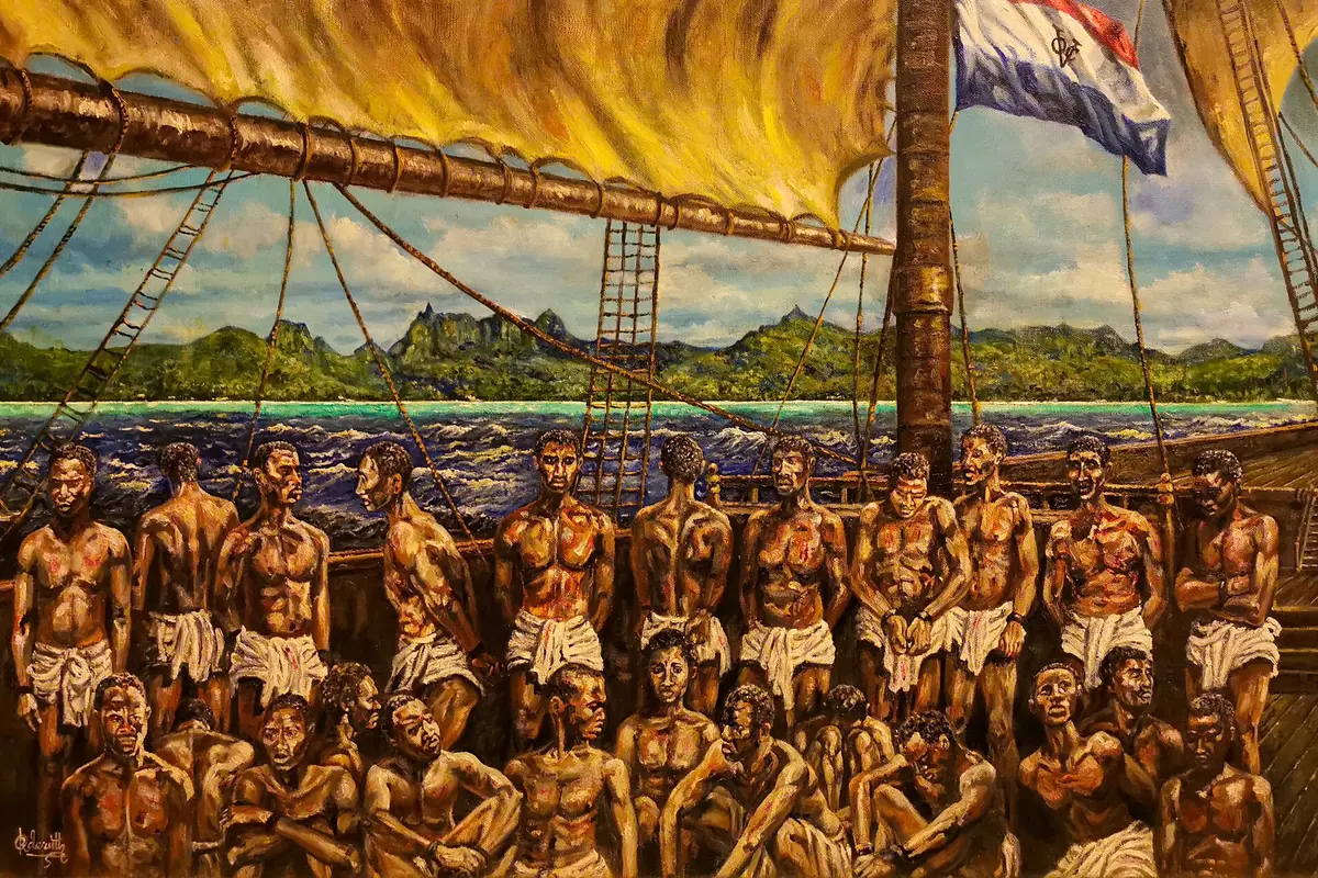
Below the peak, Le Morne beach is one of the island's most sheltered swimming bays, with casuarina trees for shade and calm water even when the trade winds pick up elsewhere. The mountain is also a place of deep memory: it was a refuge for escaped slaves in the early nineteenth century, and its UNESCO World Heritage status rests on that history rather than its beauty alone. Base yourself on the west coast for a few nights — Tamarin, Flic en Flac and Le Morne itself all work — and you can pair the hike with an early-morning boat trip from Tamarin Bay, where spinner dolphins surface in the calm water before the wind rises.
Chamarel and the Black River Highlands
Inland from the coast, the island tilts upward into a cool, misty plateau of sugar cane, forest and waterfalls. The Seven Coloured Earths at Chamarel are the headline act: a small, fenced field of undulating clay dunes banded in ochre, rust, violet and blue, formed by the weathering of volcanic basalt. It is a compact site with a viewing platform, best visited early before cloud settles over the plateau and washes out the colours, and it combines neatly with the Chamarel Waterfall a few minutes away, where a river drops roughly 100 metres in two tiers into a forested gorge.
The wider Black River Gorges National Park protects more than 6,000 hectares of the island's remaining native forest and is the best place to understand what Mauritius looked like before sugar. Viewpoints at Alexandra Falls and the Gorges overlook vast green valleys, while the Macchabée trail is a gentle half-day walk through ebony and tambalacoque trees. Serious hikers head for Piton de la Petite Rivière Noire, at 828 metres the island's highest peak, a full-day outing for fit walkers with an early start. Birdlife here is exceptional — pink pigeons, Mauritius kestrels and echo parakeets all cling on in these forests — so bring binoculars and go quietly.
Finish the loop with a stop at a Chamarel rum distillery, where cane grown on the surrounding slopes is distilled and poured for tastings, and at the ebony forest reserve, which has a raised walkway through replanted native trees. Afternoon rain is common on the plateau even in the dry season, so treat the highlands as a morning activity and keep the beach for later.
Port Louis: Markets, Museums and Creole History
The capital rewards an early start. The Central Market is the island's sensory overload in miniature — pyramids of mangoes, breadfruit and chilli, bundles of vanilla and thyme, herbalists selling remedies, and stalls frying dhal puri and gateaux piments for a few rupees. Go before 10am on a weekday, when the produce is freshest and the aisles are still navigable. A short walk away, Aapravasi Ghat is a UNESCO World Heritage Site and one of the most quietly affecting places in Mauritius: a small stone depot and flight of steps where indentured labourers from India first landed after 1834. It takes under an hour and costs nothing, and it explains the island's demographic heart better than any museum.
For context, the Blue Penny Museum tells the story of the island's colonial post and the famous 1847 stamps, while the Champ de Mars racecourse, laid out in 1812, still holds meetings on Saturday afternoons during the cooler months. Above the city, the Citadelle (Fort Adelaide) offers a free panoramic view over the harbour and the mountains beyond.
Eating is half the point of Port Louis: hunt down alouda, the milky basil-seed drink sold from carts, and boulettes — steamed dumplings in broth — from hole-in-the-wall counters. Parking is scarce and traffic heavy, so take a bus or taxi into the centre and walk. If you have a spare half-day and want a viewpoint without a full expedition, the climb up Le Pouce from the Moka side takes around three hours return.
The North: Pamplemousses, Grand Baie and Cap Malheureux
The north coast is the island's most developed corner, but it still holds two unmissable sights. The Sir Seewoosagur Ramgoolam Botanical Garden at Pamplemousses, laid out in the eighteenth century, is famous for its giant Victoria amazonica water lilies and for talipot palms that grow for decades, flower once and then die. Allow 90 minutes to two hours to wander the spice beds, the giant tortoise enclosure and the long avenue of palms; go early for cooler air and fewer people, and bring mosquito repellent.
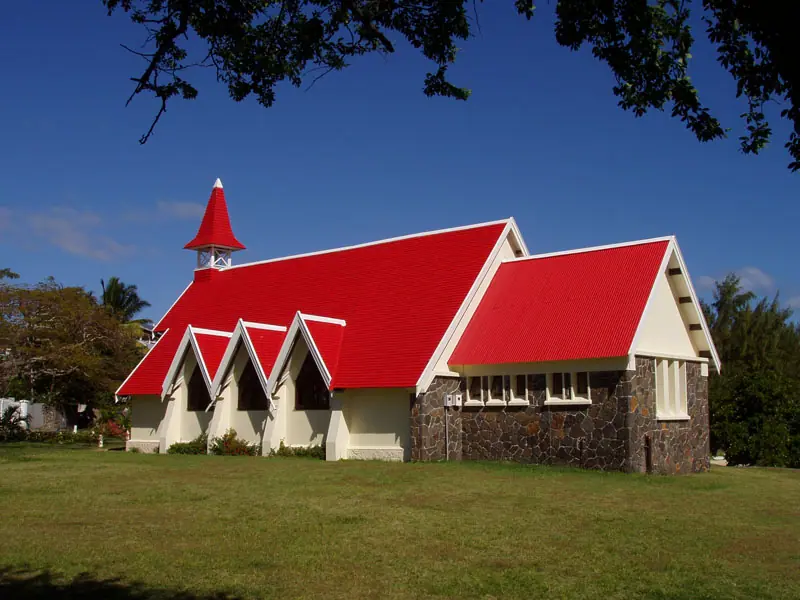
From there it is a short drive to Grand Baie, the launch point for boat trips to the offshore islets of Coin de Mire, Île Plate and Gabriel Island — good snorkelling and picnic day-trip territory when the sea is calm. For swimming, locals favour Trou aux Biches and the long sweep of Mont Choisy beach. At the northern tip, the little chapel of Notre-Dame Auxiliatrice at Cap Malheureux, with its vivid red roof and view across the water to Coin de Mire, is the island's most photographed building and a superb sunset stop.
The north is drier and breezier than the rest of the island, which makes it a sensible base from June to August, when the south-east trades can make other coasts choppier. Restaurants, guesthouses and dive schools cluster here, and the beaches are shallow and safe for children.
Île aux Cerfs, Blue Bay and the Eastern Lagoons
On the east coast, boats shuttle from Trou d'Eau Douce to Île aux Cerfs in around fifteen to twenty minutes, and the island delivers exactly what people imagine of Mauritius: white sand, shallow gin-clear water, a golf course and plenty of watersports. It gets busy, so take the first or second departure of the day and you will have the best of the beach before the catamarans arrive en masse. The mainland stretch at Belle Mare, just up the coast, is a gorgeous public beach in its own right and far quieter.
Down in the south-east, Blue Bay Marine Park near Mahébourg protects a patch of coral and seagrass that is best seen by glass-bottom boat or on a snorkelling trip — visibility is usually excellent in the calmer months from May to November. Just offshore, Île aux Aigrettes is a small nature reserve reached by guided tour of around ninety minutes to two hours, where giant Aldabra tortoises lumber through restored ebony forest and pink pigeons feed in the canopy. Tours are limited in number, so book a day or two ahead.
Mahébourg itself is a slow, faded, likeable town with a waterfront market and a small naval museum, and the coastal road to Pointe d'Esny passes some of the island's loveliest, least crowded beaches.
Volcanoes, Sacred Lakes and the Wild South
Mauritius is volcanic from top to bottom, and the interior makes that plain. In Curepipe, Trou aux Cerfs is a dormant crater roughly 600 metres above sea level with a paved path around the rim — a free, easy 30 to 45 minutes with sweeping views on a clear day. Further inland, Ganga Talao (Grand Bassin) is a sacred lake set in the hills, ringed by temples and dominated by a colossal statue of Shiva. During Maha Shivaratri in February or March, pilgrims walk here in their hundreds of thousands; at any time of year it is a peaceful, respectful stop, so cover shoulders and knees.
Nearby, the Bois Chéri tea plantation offers a look at how the island's tea is grown and processed, with tastings over a valley view, while La Vanille Nature Park keeps giant tortoises, crocodiles and an excellent insect collection — a reliable hit with children. Push further south and the landscape turns raw: Rochester Falls near Souillac drops over geometric basalt columns, and the cliffs at Gris Gris have no protecting reef at all, so the Indian Ocean hits them head-on with real force. The nearby blowhole at Le Souffleur is spectacular after rough weather, but do not swim here.
The south is the island's quietest region, with fewer resorts, narrow winding roads and a strong Creole character. A hire car or a driver for the day makes the most sense here — public buses run, but slowly, and you will want the freedom to stop at viewpoints.
Frequently asked questions
What is the best time of year to visit Mauritius?
May to November brings the coolest, driest weather, with coastal temperatures around 20-25°C — ideal for hiking Le Morne and the Black River Gorges. December to April is hotter and more humid, with afternoon showers and cyclone risk peaking between January and March. Sea temperatures stay swimmable at roughly 24-27°C all year.
How many days do you need to see the main landmarks?
Seven to ten days lets you cover the west (Le Morne, Tamarin, Flic en Flac), the central plateau (Chamarel, Black River Gorges, Grand Bassin), Port Louis, the north (Pamplemousses, Grand Baie) and a day trip to Île aux Cerfs without rushing. The island is small — most landmark-to-landmark drives take 45 to 90 minutes.
Do I need to rent a car in Mauritius?
Driving is on the left and main roads are decent, so a hire car gives you the most flexibility, particularly for Chamarel, the gorges and the south coast. Buses are cheap but slow and stop early. Hiring a taxi or driver for a full day is a good middle ground if you would rather not drive.
Is the Le Morne Brabant hike suitable for everyone?
The lower trail is manageable for most reasonably fit walkers, but the final section to the summit is steep, exposed and involves scrambling over rock. Allow two to three hours return, start before 7am, carry plenty of water and skip it if you have a fear of heights or are hiking with young children.
What should a first-time visitor not miss?
Prioritise the climb or viewpoint at Le Morne Brabant, the Seven Coloured Earths and Chamarel Waterfall, a boat day at Île aux Cerfs or Blue Bay Marine Park, the sacred lake at Ganga Talao, and a morning in Port Louis for the Central Market and Aapravasi Ghat. Add Cap Malheureux at sunset and you have seen the island's essential set.
Plan it — experiences in Mauritius
Live search, booked directly with trusted providers.
Sort the rest of your trip
Everything for Mauritius, in one place
Stay in Mauritius
Hotels, guesthouses and apartments — compared in one search.
Search hotels
Transfer in Mauritius
Private driver waiting on arrival — no queues, no surprises.
Book a transfer
Stay online in Mauritius
Travel eSIM — data the moment you land, no roaming bills.
Get an eSIM