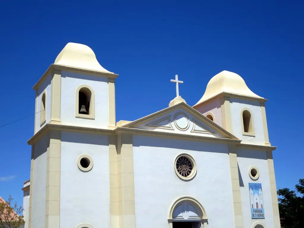
Angola is Africa's seventh-largest country and one of its least-visited, a place where the Atlantic slams into a thousand-metre escarpment, a river throws itself off the plateau in a sheet of white water, and the Namib Desert creeps north to touch the sea. Distances are long and roads demand patience, but the reward is a country of enormous, unfiltered landscapes with barely another traveller in sight.
Luanda: Fortresses, Seafood and the Rhythm of Semba
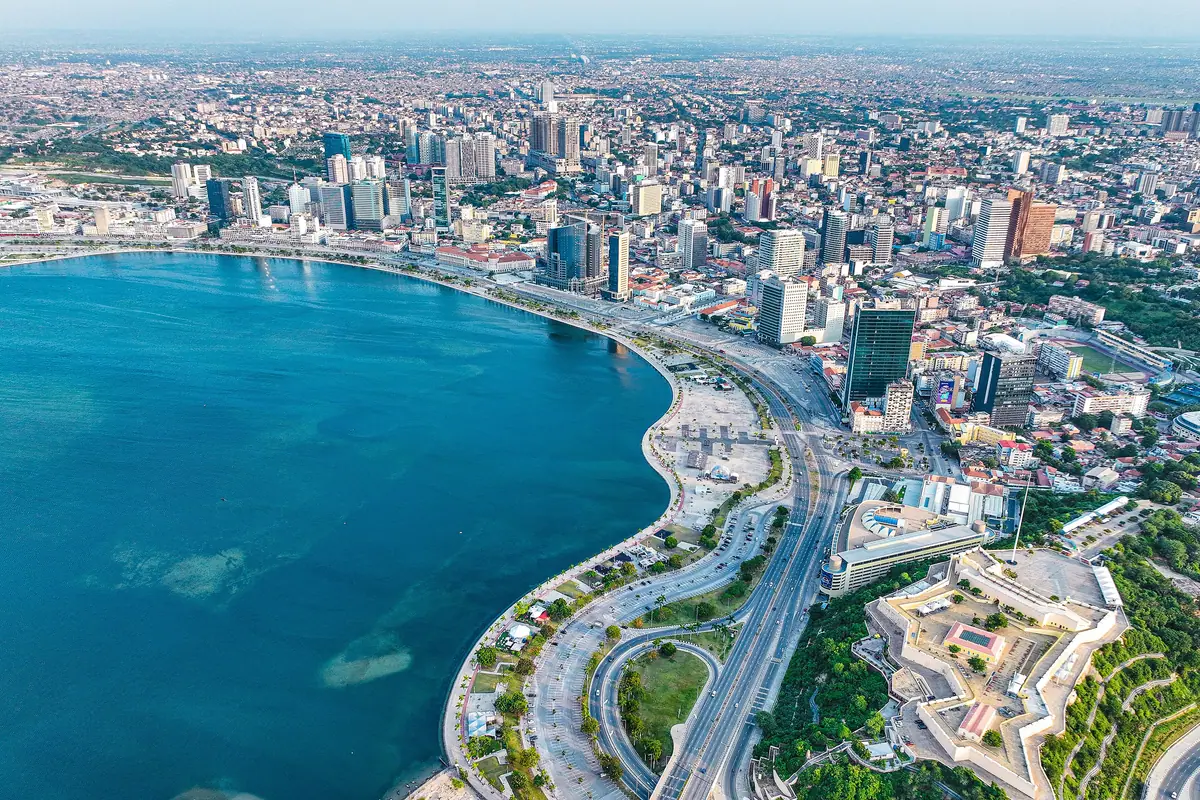
Most journeys begin in Luanda, a city of roughly eight million people curled around one of the finest natural bays on the Atlantic. The waterfront promenade known as the Marginal runs the length of Avenida 4 de Fevereiro, busy with joggers at dawn and couples at sunset, and it ends near the rocket-shaped Mausoleum of Agostinho Neto, the resting place of the country's first president. Above it, on the headland, stands the Fortaleza de São Miguel, begun in 1576 and the oldest surviving building in Angola. Now a military museum, it has a tiled courtyard, rows of rusting cannons and the best panorama of the bay.
Cross to the Ilha do Cabo, a narrow sand spit that curves for about seven kilometres and shelters the harbour. This is where Luanda eats: grilled fish and mufete, a plate of fish with beans, palm oil and chopped onion, served at tables set almost in the surf. In the afternoon the sheltered side is calm enough for a swim; after dark the bars turn up semba, kizomba and kuduro. For crafts, masks and basketwork, head to the artisan market at Benfica, and for context on the country's many peoples, the National Museum of Anthropology is small but rewarding.
About 40 kilometres south along the coast road, the Miradouro da Lua is a cliff of wildly eroded gullies that looks like a miniature lunar landscape. Back in the city, order funge, a smooth porridge of cassava or millet eaten with calulu stew or muamba de galinha, chicken cooked in palm oil with garlic and okra. If your timing is lucky, Carnival fills the streets in February or early March with a week of parades, drums and costume competitions.
Kalandula Falls and the Black Rocks of Malanje
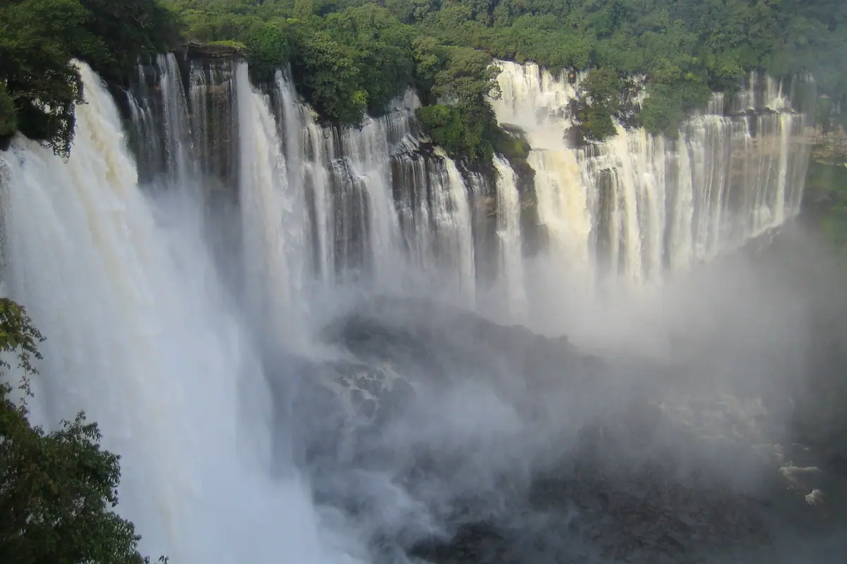
Angola's signature natural spectacle lies in the interior, roughly 400 kilometres east of the capital. Kalandula Falls drops about 105 metres from the Lucala River and spreads up to 400 metres wide when the water is high, an amphitheatre of rock and spray that ranks among the largest waterfalls in Africa. It is at its most violent between February and April, at the end of the rains, when the roar carries across the savannah and rainbows hang permanently in the mist. In the dry months from June to September the flow splits into channels, exposing polished rock pools that are safe to swim in.
Roughly 100 kilometres southwest of Malanje town stand the Pedras Negras de Pungo Andongo, a field of black boulders the size of houses piled into improbable towers and arches. This was the heartland of the Kingdom of Ndongo and the fierce queen Njinga Mbandi, who resisted Portuguese expansion for decades; local guides point out the rock hollows said to be her footprints, and the climb between the formations opens onto a vast, empty plain of baobabs and grass.
Malanje town itself is a low-key base of colonial-era streets, markets and a railway line running back toward the coast. Reaching it takes about an hour by air or a long day on the road, and the final stretch to the falls can turn rough after heavy rain, so travelling with a driver who knows the route is money well spent. Take water, cash and a full tank; fuel stops thin out quickly beyond the provincial capital.
South from Luanda: Kissama Wildlife and the Benguela Coast
Kissama National Park, usually written Quiçama, begins about 70 kilometres south of Luanda and covers some 9,600 square kilometres of acacia savannah and river valley. Its elephants were airlifted in from neighbouring Botswana in 2001, one of the more improbable conservation stories on the continent, and they now share the park with giraffe, zebra, wildebeest, buffalo and a rich birdlife along the Kwanza River. Game viewing is best in the dry months from June to September, when animals gather at the water and the bush thins; boat trips on the river, past the sandbanks and the old river mouth, are the most relaxing way to see it.
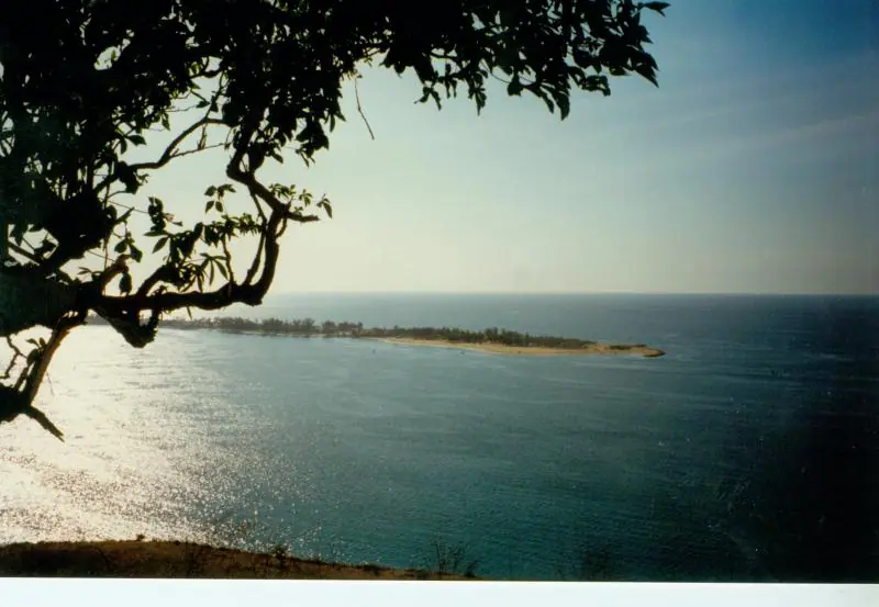
Continue south and the coastline turns wild. Cabo Ledo, with its dark cliffs and a long, reliable point break, is the country's best-known surf spot, working hardest between April and September, while nearby beaches such as Sangano offer clean sand and very few people. Further along lie Porto Amboim, Sumbe and finally Benguela, an old port town of pastel facades with the fine beaches of Praia Morena, Baía Azul and Baía Farta at its edge. Next door, the sand spit of the Restinga in Lobito separates a calm lagoon from the open ocean and is the place for sailing, paddling and sunset fish dinners.
The drive from Luanda to Benguela runs close to 600 kilometres and, while much of it is tarred, expect potholes, freight traffic and checkpoints, so allow a full day and never drive outside the cities after dark. Watching from the headland at Cabo Ledo or from a boat off Lobito, dolphins are common, and in the cooler months migrating whales pass close to shore.
Lubango, the Serra da Leba Pass and the Tundavala Gap
Lubango sits at around 1,760 metres in the Huíla highlands, where the air is cool, the jacarandas are purple in spring and evenings call for a jacket. Above the city, on the ridge of the Serra da Chela, the Cristo Rei do Lubango opens its arms over the rooftops, a smaller counterpart to the famous statue in Brazil. The hill of Nossa Senhora do Monte, crowned by a small chapel, is the local sunset spot, with views across the plateau and cold, clear night skies.
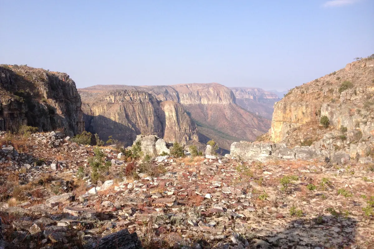
Two viewpoints nearby justify the journey on their own. The Serra da Leba pass corkscrews down the escarpment toward the desert, its name painted in white letters on the slope, and the roadside miradouro looks straight down the hairpins to the plain far below. Thirty kilometres out of town, the Tundavala Gap is a sheer notch in the cliff edge where the plateau drops roughly a thousand metres to the Namib; stand at the rim at sunrise and you look over an ocean of sand and haze. Bring layers and hold on to your hat, as the wind funnels hard through the gap.
Lubango is reached by a short domestic flight from Luanda or by a long, scenic drive across the plateau. Clear views are most likely between May and September, and the mornings are almost always sharper than the afternoons, when cloud boils up from the desert and swallows the edge of the world.
The Namib Desert, Welwitschia and Iona National Park
South of the escarpment, the desert meets the sea at Namibe, a Portuguese-era port of wide avenues, a working fish market and beaches like Praia Amélia where cold Atlantic currents keep the water bracing. Along the road toward Tômbwa, watch for welwitschia, a living fossil with just two leaves that sprawl across the gravel and can live for many centuries. Tômbwa itself has salt pans, flamingos and a sheltered bay, and the dunes at Barreira Vermelha glow rust-red in late light.
Beyond that lies Iona National Park, the largest protected area in the country at some 15,000 square kilometres of dunes, canyons, gravel plains and dry riverbeds. Oryx, springbok and mountain zebra wander here, along with brown hyena and a handful of desert-adapted elephants. At the far southern edge, where the Cunene River finally reaches the Atlantic, the abandoned settlement of Baía dos Tigres stands half-buried in sand, cut off from the mainland by a shifting bar and reachable only by boat or serious four-wheel drive.
This is self-sufficient territory: there is no fuel, water or food beyond Namibe and Tômbwa, phone coverage is patchy and travel should be in convoy with a local guide, spare tyres and plenty of water. June to September brings the most comfortable temperatures, while December to March is punishingly hot. The compensation is night skies so dense with stars that the desert horizon is sometimes hard to pick out.
Mbanza Kongo and the Northern Provinces
In the far north, close to the border with the Democratic Republic of the Congo, Mbanza Kongo was the capital of the Kingdom of Kongo and has been recognised as a World Heritage site. The heart of the old city is the Kulumbimbi, a broad platform of ruins where the royal palace and an early cathedral once stood, shaded by a vast sacred tree. A small museum displays carved figures, ceremonial objects and the archaeology of a kingdom that traded and negotiated with Europe on its own terms for centuries.
The surrounding provinces of Zaire, Uíge and Cabinda are green, humid and far less travelled. At Soyo, near the mouth of the Congo River, mangrove channels thread through the delta and boats run out past sandbanks where the river's brown water stains the sea. The Cabinda enclave further north holds a patch of the Mayombe rainforest, thick with butterflies and birds, and a coastline of quiet beaches such as those around Lândana. This is the wettest corner of Angola, with heavy rain from October to April and sticky heat year-round, so aim for the drier months from May to September and allow extra time for rough roads.
Frequently asked questions
When is the best time to visit Angola?
The dry season from May to September, known locally as the cacimbo, brings cooler temperatures, clear skies and easier roads, making it ideal for the highlands and the coast. The rains fall roughly from November to April. If seeing Kalandula Falls in full flood matters most, travel late in the wet season, between February and April, and accept that some rural tracks will be muddy.
How do I get around Angola?
Domestic flights link Luanda with Lubango, Namibe, Malanje and other provincial capitals, which saves enormous time given the distances. On the ground, a hired four-wheel drive with a driver is the most practical option for remote areas such as Kissama, the Tundavala area and especially Iona National Park. A restored railway also climbs from the coast at Lobito onto the central plateau.
What should I eat and drink in Angola?
Look for funge, a smooth cassava or millet porridge served with stews, calulu of fish or meat with greens, and muamba de galinha, chicken braised in palm oil with garlic and okra. On the Ilha do Cabo in Luanda, mufete, grilled fish with beans and onion, is the classic order. Bottled water is widely available and the safest choice in rural areas.
How many days do you need in Angola?
Seven to ten days covers Luanda well plus either the Malanje waterfalls or the Benguela and Lobito coast. Two weeks lets you add the Lubango highlands and the Tundavala Gap, and three weeks or more is realistic if you want to push on into the Namib Desert and Iona National Park, where travel is slow and self-sufficient.
Is Angola easy to travel independently?
Luanda and the main provincial towns are straightforward, but outside them infrastructure thins out quickly. Fuel, accommodation and mobile coverage can be scarce, several languages are spoken, and Portuguese is essential outside the cities. For the far south, the northern border regions and national parks, arranging a local guide and a properly equipped vehicle is strongly advised.
Plan it — experiences in Angola
Live search, booked directly with trusted providers.
Sort the rest of your trip
Everything for Angola, in one place
Stay in Angola
Hotels, guesthouses and apartments — compared in one search.
Search hotels
Transfer in Angola
Private driver waiting on arrival — no queues, no surprises.
Book a transfer
Stay online in Angola
Travel eSIM — data the moment you land, no roaming bills.
Get an eSIMMore guides in Angola
Flying Into Angola: A One-Week Itinerary from Luanda to the Kalandula Falls
The Best Time to Visit Angola: Seasons, Hotel Timing and Must-See Sights
Best Places to Visit in Angola: Luanda, Kalandula Falls and the Namibe Desert