El Salvador is barely bigger than a long weekend's road trip, yet it squeezes in smoking volcanoes, a village buried under volcanic ash, black-sand surf breaks and colonial towns painted in indigo and bougainvillea. Distances are short, the highways are good, and the headline sights sit close enough together to string into a single week. Here is how to see the best of it without rushing.
San Salvador: Cathedral, Colours and a Crater on the Edge of Town
Start in the capital, which spreads across a high valley beneath the forested shoulder of Volcán de San Salvador. The historic centre clusters around Plaza Libertad and Plaza Barrios, where the Catedral Metropolitana — with its rainbow-striped facade and the tomb of Óscar Romero — faces the arcaded Palacio Nacional. A few blocks away, Iglesia El Rosario looks plain from the street, but step inside and sunlight pours through a curved concrete grid, scattering colour across the nave. It is one of the most surprising pieces of modern religious architecture in Central America and takes only a few minutes to visit. The centre is liveliest on weekday mornings; pair it with an evening elsewhere rather than lingering after dark.
For context on everything you will see later, spend an afternoon in the museums around Parque Cuscatlán: the national anthropology museum tells the story from pre-Hispanic villages through the colonial era, while the modern art museum next door covers twentieth-century painting and sculpture. A short drive west, the Monumento al Divino Salvador del Mundo marks the country's symbolic heart and makes a quick photo stop. Come evening, head uphill to Paseo El Carmen in Santa Tecla, a pedestrian strip of cafes, bars and street grills where you can eat pupusas hot off the griddle with curtido and a cold drink.
Save one morning for the volcano itself. Parque Nacional El Boquerón protects the crater of Volcán de San Salvador, a short, cool drive from the city where pine trees, hydrangeas and mist replace the traffic below — bring a light jacket, since it is several degrees colder than downtown. From the rim you look down into a deep, green-wooded bowl and, on clear days, out toward the Pacific plain. On the way back, detour to Puerta del Diablo, a pair of rock outcrops above the village of Panchimalco that frames the valley like a natural balcony; it is at its best in late-afternoon light, and Panchimalco's whitewashed colonial church and Sunday craft market are worth an extra half hour.
Joya de Cerén and the Maya Route: Ancient Ruins Without the Crowds
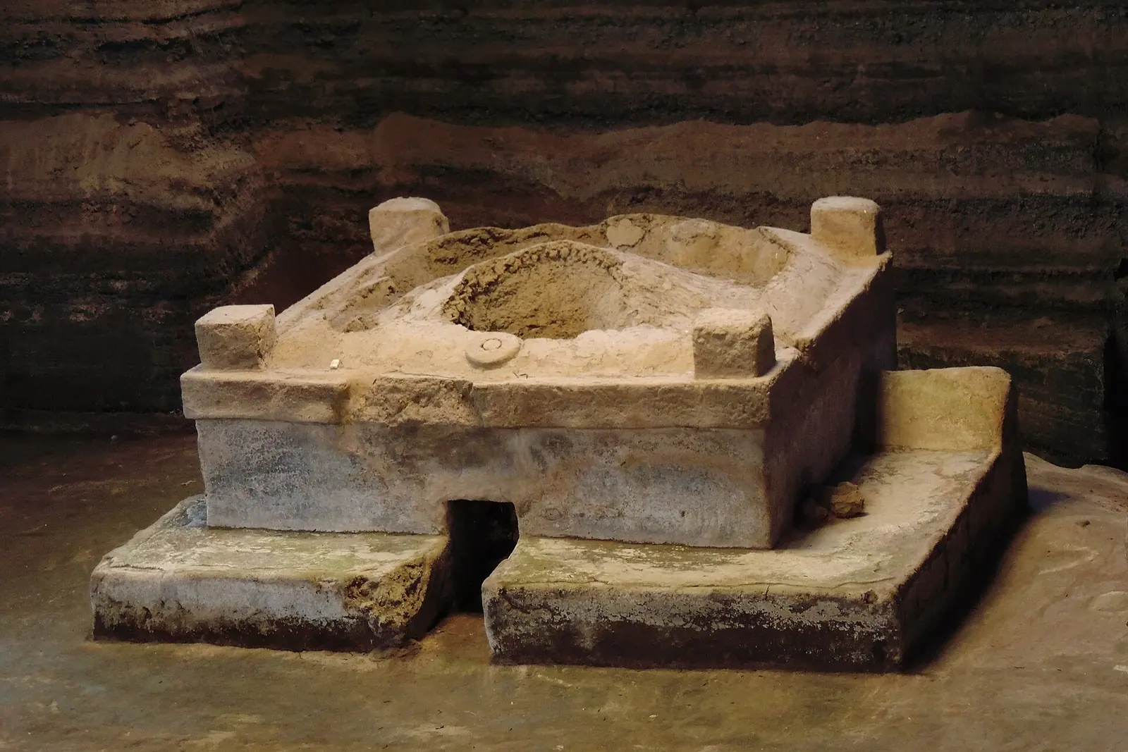
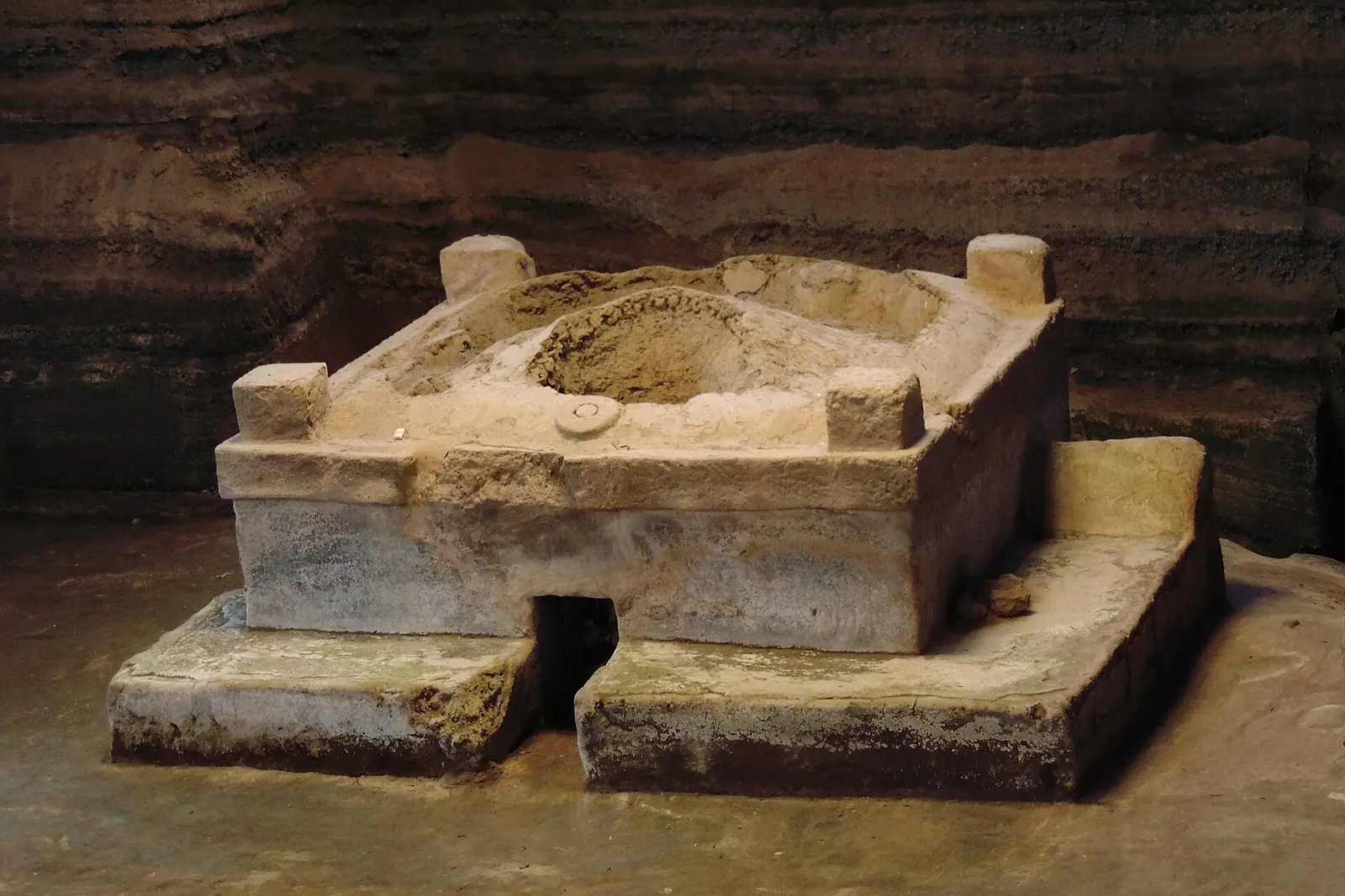
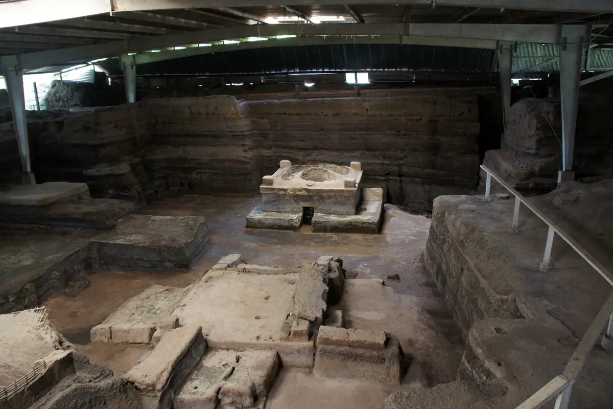
El Salvador's most extraordinary archaeological site is also its quietest. Joya de Cerén, a World Heritage site in the Zapotitán valley, is a farming village that was sealed under a layer of volcanic ash around 600 AD and never reoccupied. Because the ash fell gently, everyday life survived: earthen floors, kitchen hearths, storage jars, sleeping benches, a sweat bath and even planting beds where maize and manioc were growing when the eruption hit. Walkways loop through the excavated shelters in roughly an hour, and the small site museum explains what the ash preserved. Arrive early, when the light is soft and the tour groups have not yet appeared.
Nearby San Andrés covers the ceremonial side of the same world — a compact complex of pyramids, plazas and a ball court that once governed this valley. It is an easy add-on, and the surrounding area still produces indigo, so you can see dyeing vats and buy naturally dyed cloth from local workshops. Further west, in Chalchuapa near Santa Ana, Tazumal holds the country's largest excavated pyramid, a stepped structure with drainage channels and a ball court, plus a museum of carved stone. Ten minutes away, the Casa Blanca archaeological park adds another pyramid group and a small museum covering the region's unusually long occupation.
The whole route is refreshingly compact. Joya de Cerén and San Andrés can be combined in a half-day trip from San Salvador, roughly forty minutes of driving each way; Tazumal and Casa Blanca fill another half-day from Santa Ana. Several sites close on Mondays, so plan around that, carry cash for entrances and small vendors, and take water — the valley is hot by midday and shade is limited between the excavated shelters.
Volcán de Santa Ana, Izalco and the Turquoise Bowl of Lake Coatepeque
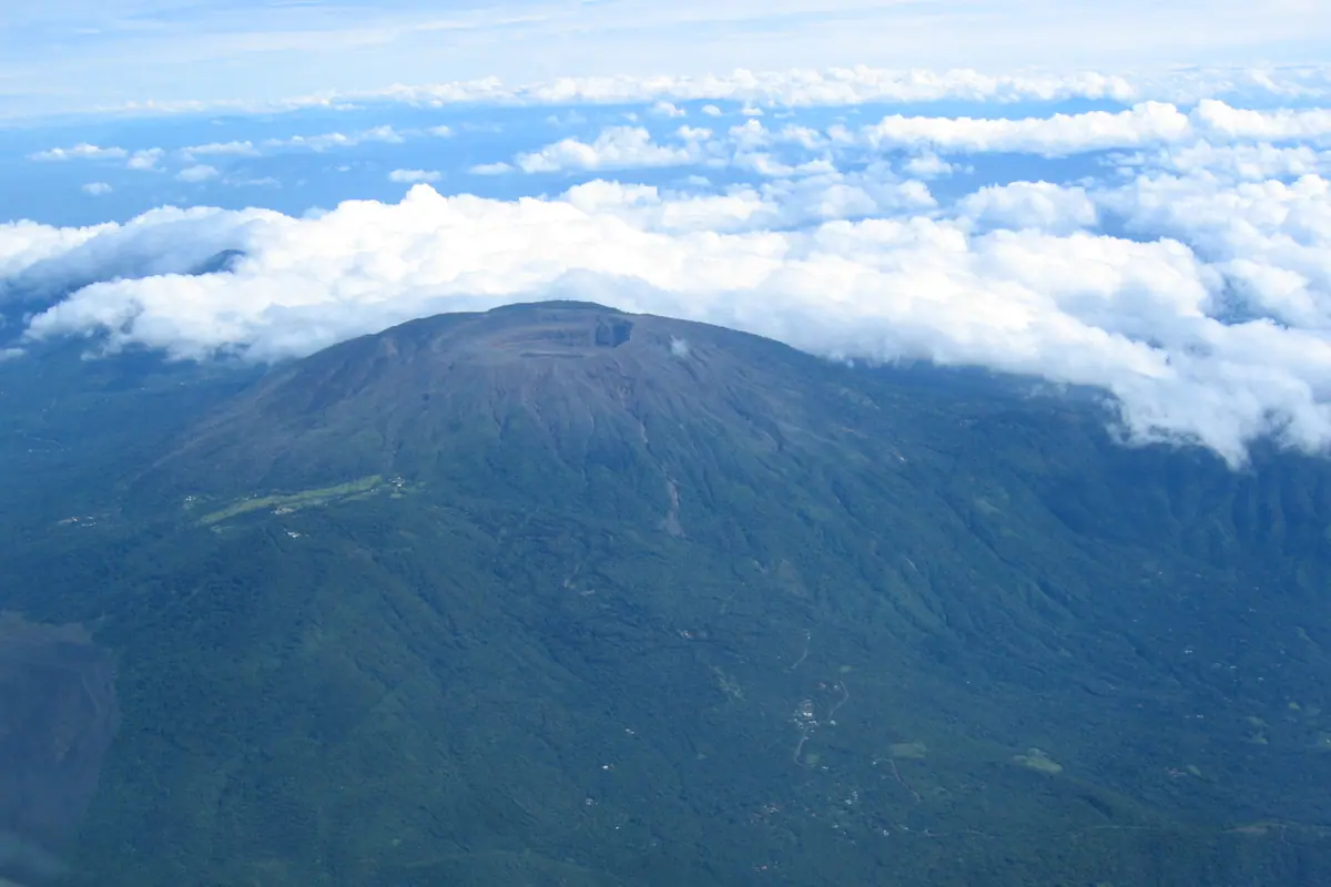
The hike up Volcán de Santa Ana, also called Ilamatepec, is the classic Salvadoran trek. At about 2,380 metres it is the country's highest and most active volcano, and the ascent from the Cerro Verde side takes roughly an hour and a half to two hours on a well-worn trail of ash and rock, with one steep, windy stretch near the top. Access is controlled: guides lead groups up at set morning times, and you will be asked to register and show identification, so arrive early and expect to wait for the group to form. The reward is a crater holding a milky, sulfur-green lake, with Izalco's perfect black cone to one side, Lake Coatepeque glinting below and the Pacific haze on the horizon.
Even if you skip the summit, the Cerro Verde visitor area is worth the trip. A gentle cloud-forest loop, about an hour at an easy pace, winds past mossy trunks, orchids and bromeliads, with gaps in the trees opening onto the two volcanoes. From the same ridge you can tackle Izalco, the so-called Lighthouse of the Pacific, which erupted almost continuously from the eighteenth century until 1966 and now offers a shorter, hotter climb of roughly an hour and a half over loose lava and ash to a bare, windy rim.
Down the road, Lake Coatepeque fills the caldera of an ancient collapsed volcano. The water is warm and startlingly turquoise, ringed by steep green slopes and weekend houses, with kayaks for hire and lakeside restaurants serving fresh fish. It is far more peaceful on weekdays; weekends bring jet skis, music and traffic. Finish in Santa Ana city, where the neo-Gothic cathedral's carved facade, the ornate Teatro de Santa Ana and the busy central market make a pleasant half-day before or after the volcanoes.
Ruta de las Flores: Colonial Towns, Coffee and Seven Waterfalls
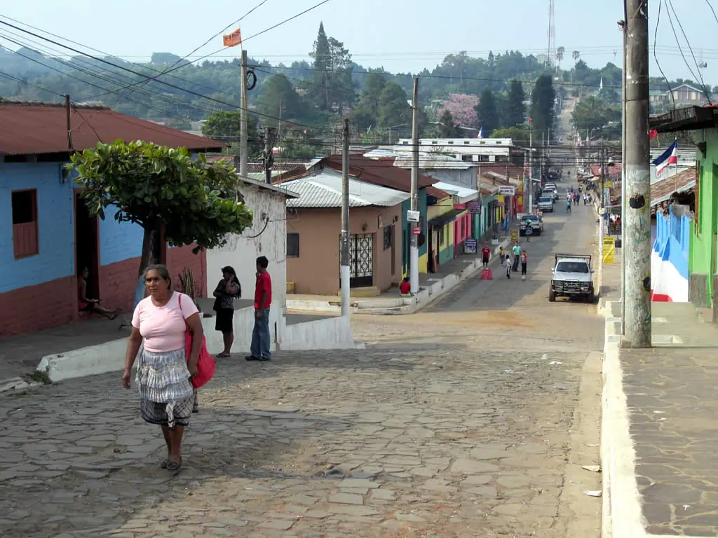
The Ruta de las Flores threads through the coffee highlands of the west, linking a string of small towns where cobblestones, painted facades and cool mountain air replace the heat of the coast. Nahuizalco, at the low end, is known for wicker and indigo and for a lively night market. Salcoatitán is a sleepy pause, and then comes Juayúa, whose weekend food festival draws crowds for grilled meats, pupusas and sweets. Just outside Juayúa, a short trail leads to Los Chorros de la Calera, a set of cascades and pools where you can swim — go with a local guide, as the path crosses private land and can be slippery after rain.
Higher up, Apaneca is the route's coolest and highest town, surrounded by cloud forest and coffee estates that offer tours through the picking and roasting process. There are ziplines strung between the hills and two small crater lakes, Laguna Verde and Laguna de las Ninfas, hidden in the trees. Concepción de Ataco is the prettiest stop of all: a tight grid of cobbled streets, mural-covered walls, weaving cooperatives and craft shops, with genuinely cold nights at around 1,200 metres. It makes the best base, since Juayúa, Apaneca and the ruins at Tazumal are all within an easy drive.
Timing matters here. Coffee is picked from roughly November through February, when the slopes are busy with baskets and the estates are at their most interesting. The flowers that give the route its name bloom in bursts after the first rains, and the landscape is greenest from June to October, though afternoons often bring heavy showers. Two nights is ideal, and the towns are close enough that you can hop between them by local bus or short taxi rides rather than committing to a car.
Black-Sand Surf Towns and the Pacific Coast
El Salvador's Pacific shoreline faces straight into the southwest swell, and the surf towns along the La Libertad coast have become the country's second tourism hub. El Tunco is the hub itself: a small crescent of black sand, a distinctive rock formation at one end, and a strip of hostels, cafes and pupusa shacks that fills up on weekends. Next door, El Sunzal is the classic longboard wave — a slow, forgiving right-hand point break that rolls for hundreds of metres and is the best place in the country to learn. La Libertad's malecón, a short drive away, has a working fish market where you can eat ceviche and grilled catch within sight of the boats.
A little further along, El Zonte offers quieter mornings and a more laid-back feel, with rocky pools at low tide and easy access to several breaks. The surf season runs roughly from March to October, when the swell is most consistent; mornings are usually glassy and offshore, with the wind turning onshore by early afternoon and chopping the surface. Lessons typically last about two hours including board hire, and most towns have several schools happy to take complete beginners. Outside the swell months the waves are smaller but the line-ups are empty and accommodation is cheaper.
East of the capital, the coast turns wilder and wetter. The Bahía de Jiquilisco is a vast maze of mangroves and islands where you can kayak through tunnels of roots, spot turtles and visit remote communities; Isla El Espíritu Santo is the launch point for boat trips. Further east, Playa El Cuco draws Salvadoran families for its long grey-brown sand and gentle swimming. For something different, head to Los Cóbanos in the west, where a rocky reef shelters shallow pools full of starfish and small fish — good for snorkelling on calm days — and the Gulf of Fonseca in the far east offers boat trips out to volcanic islands shared with neighbouring countries.
Suchitoto, El Imposible and the Cool Northern Highlands
North of the capital, Suchitoto is many travellers' favourite town: whitewashed houses, cobbled lanes, a handsome colonial church, Santa Lucía, overlooking a wide lake, and workshops where indigo is still fermented and dyed by hand. Below the town, Lake Suchitlán spreads out in a maze of inlets and wooded islands; small boats run birdwatching trips at dawn, when herons, kingfishers and egrets are most active. Two hours away, La Palma is famous for its bright, folk-art murals and painted crafts, and the nearby site of Cihuatán preserves a large ceremonial centre with pyramids and a ball court from a later, post-Maya period.
For hiking, the north and west hold the country's best forests. El Imposible National Park, in the far west, has a network of trails that drop through steep, bird-rich woodland to waterfalls and swimming holes; the trails are rugged and best done with a local guide, and the park is home to hundreds of bird species plus pumas, ocelots and armadillos. Further north near Metapán, the Montecristo cloud forest straddles three countries and is reached by a rough mountain road — expect mist, orchids and mud, and go early to catch the clearest weather.
The far northeast is cooler, pine-covered and history-heavy: Perquín's Museum of the Revolution and the memorial at El Mozote document the country's civil war, and locals run guided walks through the old guerrilla heartland. Near the Honduran border, Cerro El Pital rises to about 2,730 metres, the country's highest point, where pine forest, cold nights and camping replaced tropical heat. Realistically, eight to ten days covers the highlights comfortably, and two weeks lets you add the eastern coast and the northern highlands without rushing. The dry season, from November to April, is the best window for hiking and beaches; from May to October, expect afternoon downpours, lush green hills and far fewer visitors.
Frequently asked questions
How many days do I need to see El Salvador's main sights?
Eight to ten days is a comfortable pace: two or three nights split between San Salvador and the Santa Ana volcano area, two nights on the Ruta de las Flores, two on the Pacific coast around El Tunco, and one or two in Suchitoto. Because distances are short — rarely more than three hours between regions — you can also cover the highlights in five or six busy days, or stretch to two weeks by adding the eastern coast and the northern highlands.
What is the best time of year to visit El Salvador?
The dry season, roughly November through April, is the most reliable window: sunny mornings, clear volcano views and firm trails. March and April are the hottest months on the coast. From May to October the country turns green and lush, prices drop, and rain usually arrives as heavy afternoon showers rather than all-day drizzle — perfectly workable if you plan hikes and sightseeing for the morning.
Do I need a car to get around?
Not strictly. Frequent local buses connect most towns on the main routes, and shared shuttles or taxis handle the awkward legs, such as getting up to Cerro Verde or El Boquerón. That said, a rental car gives you far more freedom for the Ruta de las Flores, the archaeological sites and the quieter beaches, and road conditions on the main highways are generally good. If you drive, avoid travelling unfamiliar mountain roads after dark.
Which beach is best for beginner surfers?
El Sunzal, just past El Tunco, is the classic learning wave: a long, gentle right-hand point break with a sandy bottom and plenty of room. The nearby towns of El Tunco and El Zonte have several surf schools offering two-hour lessons that include a board and rash guard. The most consistent swell runs from March to October, and early mornings are best before the onshore wind picks up.
What should I know about money and safety?
The US dollar is the official currency, and small bills are useful for market stalls, buses, site entrances and pupuserias — many rural places take cash only, so keep a supply on hand. As for safety, the well-trodden tourist circuits including San Salvador's museums, the Ruta de las Flores, the volcano parks and the surf towns are generally fine for visitors; travel in daylight where possible, use registered guides for hikes, keep valuables out of sight and take local advice on which neighbourhoods to avoid after dark.
Plan it — experiences in El Salvador
Live search, booked directly with trusted providers.
Sort the rest of your trip
Everything for El Salvador, in one place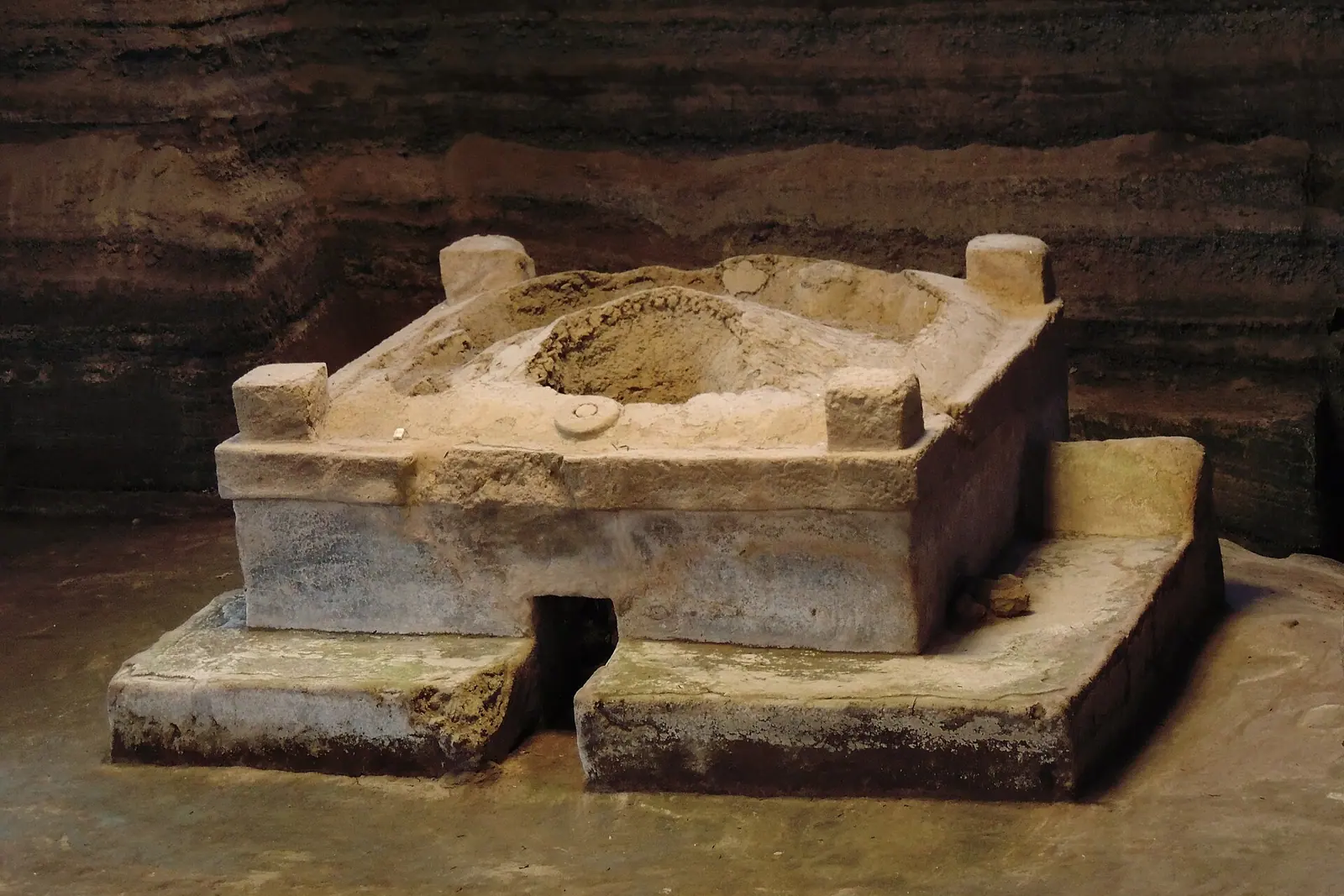
Stay in El Salvador
Hotels, guesthouses and apartments — compared in one search.
Search hotels
Transfer in El Salvador
Private driver waiting on arrival — no queues, no surprises.
Book a transfer
Stay online in El Salvador
Travel eSIM — data the moment you land, no roaming bills.
Get an eSIM