Lesotho is the rare country that reveals itself first from a cabin window — a crumpled quilt of sandstone and basalt stitched by switchback roads. Land at Moshoeshoe I International Airport and you are already 1,600 metres above sea level, in a kingdom entirely surrounded by South Africa. This is a one-week loop built around arriving by air and moving through the highlands by 4x4, pony and foot.
Arriving by Air: Landing in the Mountain Kingdom
Almost every first-time visitor meets Lesotho through a porthole. Moshoeshoe I International Airport lies roughly 20 kilometres south-east of Maseru, the capital, on a high plateau where the approach is framed by flat-topped hills. International connections are thin — a small number of regional services from neighbouring hubs, often on turboprops with tight baggage limits — so plenty of travellers fly into a larger South African city and either connect onward or make the five-to-six-hour drive to the Maseru Bridge border, crossing the Caledon River into the capital.
Beyond the main runway, flying in Lesotho means small aircraft. Charter operators use light planes to reach unpaved highland airstrips such as Mokhotlong and Lebakeng, and short scenic hops over the Maloti range reveal the escarpments, dams and pony tracks that roads take hours to reach. Build a buffer day at each end of your trip: mountain cloud and crosswinds routinely delay departures, and thin air at altitude reduces aircraft performance in ways lowland travellers rarely expect.
Practically, this is a country where planning beats improvisation. The local currency is the loti, pegged one-to-one to the South African rand, which is accepted almost everywhere; outside Maseru, cash matters more than cards. Traffic drives on the left. If your week goes beyond the capital and the main lowland roads, hire a high-clearance 4x4 — the passes that make Lesotho unforgettable are exactly the ones a saloon car cannot climb.
Days 1–2: Maseru, Thaba Bosiu and the Lowland Cradle
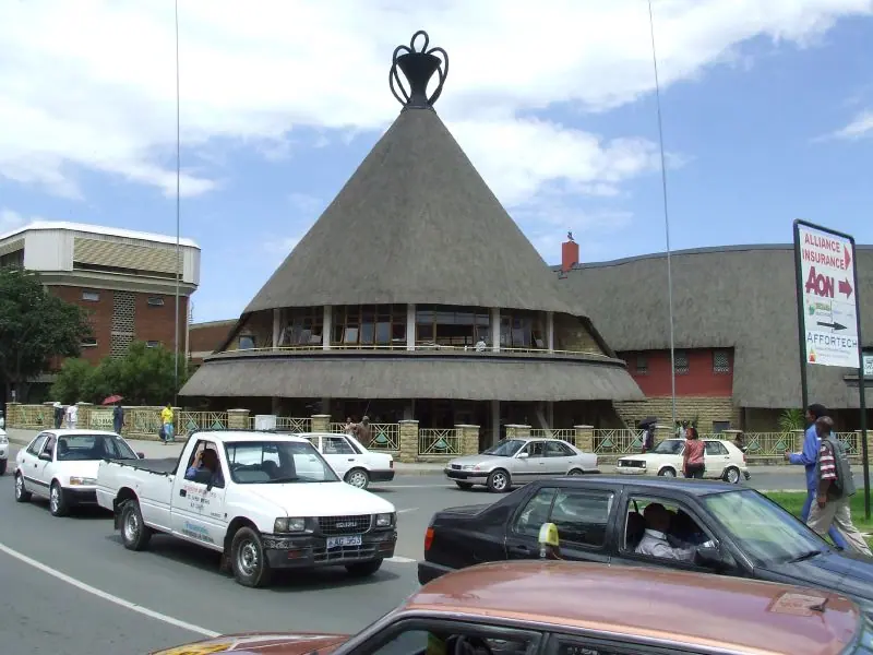
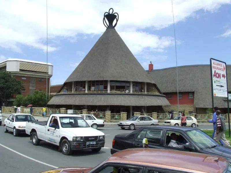
Start gently and let your body adjust to the altitude. Maseru's Kingsway is walkable and unhurried: the statue of King Moshoeshoe I stands near the centre, the Basotho Hat building is shaped like the woven mokorotlo headgear that has become a national emblem, and the Cathedral of Our Lady of Victories rises above the market district. Spend a morning browsing the craft stalls near the border bridge, where traders sell Basotho blankets, basketry and pony-hair ropes, then break for lunch in the capital before heading east.
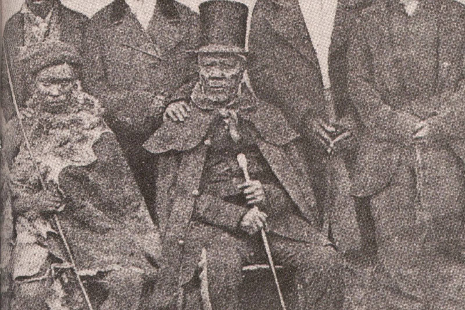
Twenty kilometres east of the city, Thaba Bosiu — 'Mountain of the Night' — is the single most important historic site in the country. This flat-topped sandstone plateau was the mountain fortress of King Moshoeshoe I and the birthplace of the Basotho nation, defended by cliff walls and springs rather than stone ramparts. Guided walks climb to the summit past the graves of kings, and a cultural village at the foot explains the legend of the plateau that supposedly grew overnight whenever enemies approached.
Give the second day to the lowland valleys. At Morija, the country's oldest museum and archive holds missionary-era documents and Basotho artefacts, with dinosaur footprints in the sandstone nearby. Further along, the rock paintings at Ha Baroana shelter under an overhang, and the Kome Caves — hollowed sandstone dwellings still used by descendants of their builders — are among the most quietly remarkable places in southern Africa. Stop in Teyateyaneng to watch tapestry weavers at work on the way back.
Day 3: Roma to Semonkong and Maletsunyane Falls
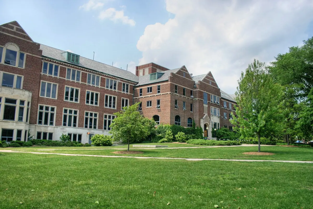
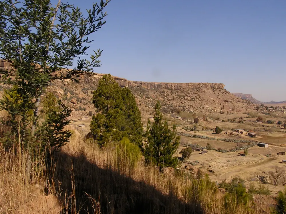
Head south from Maseru into the Roma Valley, where the National University of Lesotho occupies a campus of colonial-era buildings and the Roma Cathedral anchors one of the country's oldest Catholic missions. The valley's clay slopes are rich in dinosaur tracks and fossils, and local guides can point out the best footprints.
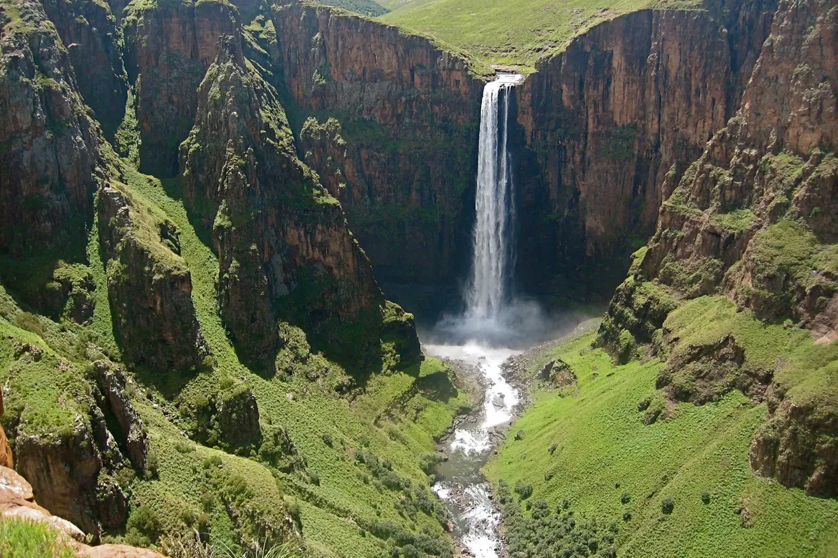
From Roma the road turns east and climbs toward Semonkong — 'the place of smoke' — named for the mist that hangs over its gorge. Here the Maletsunyane River throws itself roughly 190 metres off a basalt lip in a single unbroken drop, one of the highest waterfalls in the region. In the dry winter months it is a slender silver ribbon; after summer rains it becomes a roaring white curtain that soaks anyone standing at the viewpoint.
Take the rough gorge trail down to the base — about 45 minutes each way on foot, with scrambles and slick rock — or watch others descend beside the falls on one of the longest single-drop commercial abseils anywhere in the world. Accommodation here is simple and village-based: guesthouses with corrugated roofs, hot water bottles in winter, and dinners of chicken, maize porridge and wild greens. Bring a headlamp; power cuts are part of the rhythm.
Day 4: Pony Trekking and the Basotho Highlands
Lesotho's Basotho ponies were bred for mountains — sure-footed, patient and unbothered by heights — and riding one is the most honest way to cover ground here. Multi-hour and multi-day treks leave from Semonkong and from the Malealea Valley, where steep sandstone cliffs shelter San rock paintings, a waterfall where trails end in a cold plunge pool, and evenings that often end in singing and a locally made guitar.
A half-day on horseback can put you above the cloud line, crossing passes that no vehicle uses and visiting shepherd posts where boys wrapped in blankets watch flocks of sheep and angora goats. Shepherds still wear the Seanamarena blanket and the conical mokorotlo hat; greeting them in Sesotho, even clumsily, unlocks conversation and directions.
Time this for April to September if you want reliable dry trails underfoot and hard, clear skies. From October the highlands turn green and dramatic, but afternoon thunderstorms roll in fast, hail is common above 2,500 metres, and river crossings become genuinely dangerous. Whichever season you choose, ride early and be off exposed ridges by mid-afternoon.
Day 5: Katse Dam, Bokong and the Maloti Highlands
The long drive north to Katse is the scenic centrepiece of any Lesotho itinerary. The road twists through the Mafika Lisiu Pass at over 3,000 metres, and from the ridge above the Malibamat'so River you finally see the dam wall: a soaring double-curvature concrete arch, around 185 metres high, holding back a reservoir of drowned valleys and drowned villages — part of the water transfer scheme that sends Lesotho's rain to South Africa's industrial heartland.
Guided tours go inside the dam wall, and the botanical garden on its shore explains how Basotho healers use the highland flora. On the way, pause at the Bokong Nature Reserve near the pass, where alpine views open for hundreds of kilometres and bearded vultures ride the thermals below you. The Lepaqoa waterfall nearby freezes into a column of ice in the depths of winter.
Add the Liphofung Cave Cultural Historical Site near Pitseng, a sandstone shelter with rock art and a long association with King Moshoeshoe I, and finish in Ts'ehlanyane National Park, a rare pocket of montane forest with day hikes through bushman's tea and ouhout trees, clear streams, and wooden cabins for the night. Nights at this altitude are cold year-round — expect frost from May to August.
Days 6–7: Sani Pass, Sehlabathebe and the Flight Home
Leave the last two days for the east. Sani Pass is the only road connecting Lesotho's highlands with the South African province of KwaZulu-Natal, and it is a serious climb: a switchbacked 4x4 track that tops out at 2,874 metres, with border formalities at the summit and a pub at Sani Top that claims to be the highest in Africa. On a clear day you look down the escarpment over the Drakensberg. Snow closes the pass in winter, and mist can shut it in minutes, so check conditions locally before committing.
If you have the appetite for a detour, Sehlabathebe National Park in the far south-east is Lesotho's oldest protected area and, with its South African neighbour, part of a UNESCO-listed transboundary mountain park. Sandstone arches, pools and rock art sit among rare alpine plants and near-endemic birds, and it is reached only by rough road from Qacha's Nek. In June to August, travellers who want snow can spend an afternoon on the small ski field high on the Mahlasela Pass instead.
Then return to Maseru for your flight — and budget a full day's drive to get there from the highlands, more if it has rained. Arrive a night early in the capital, repack your blanket and basket souvenirs, and take a last look at the plateau from the departure lounge. Lesotho is a country that rewards those who leave slack in the schedule and let the mountains set the pace.
Frequently asked questions
Do you have to fly to reach Lesotho?
No, but flying is the quickest option. Moshoeshoe I International Airport sits about 20 kilometres from Maseru and handles a small number of regional services; most long-haul travellers fly into a larger southern African hub and either connect or drive five to six hours to the Maseru Bridge border. Light charter aircraft also serve unpaved highland airstrips.
When is the best time for a week in Lesotho?
April to September brings dry trails, crisp air and reliable visibility in the highlands, though nights drop below freezing from May to August. October to March is greener and warmer, with spectacular thunderstorms and hail above 2,500 metres — start outdoor activities early and be off ridges by afternoon.
Do I need a 4x4 for this itinerary?
Yes, if you plan to drive yourself beyond Maseru and the main lowland roads. Sani Pass is 4x4-only, Katse Dam roads are steep and unpaved in places, and the mountain passes become slick in rain or snow. Alternatively use guided 4x4 transfers and pony treks.
How does the altitude affect travellers?
Maseru sits near 1,600 metres and many passes exceed 3,000 metres, so give yourself a day or two to acclimatise, drink more water than usual, limit alcohol early on, and take climbs slowly. Altitude also affects light-aircraft performance, which is one reason mountain flights can be weight- and weather-restricted.
What money and connectivity should I bring?
The loti is pegged one-to-one to the South African rand, and rand notes are widely accepted. Cards work in Maseru hotels and larger shops but not in villages, so carry cash. Mobile coverage is decent in towns and patchy in the highlands; buy a local SIM in the capital rather than relying on roaming.
Sort the rest of your trip
Everything for Lesotho, in one place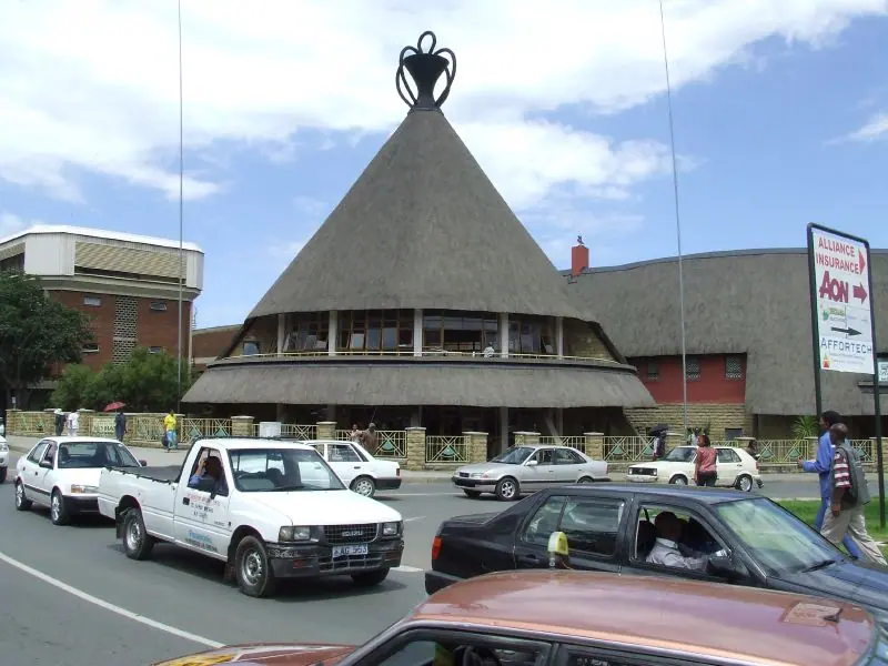
Stay in Lesotho
Hotels, guesthouses and apartments — compared in one search.
Search hotels
Transfer in Lesotho
Private driver waiting on arrival — no queues, no surprises.
Book a transfer
Travel insurance
Medical cover, delays and lost baggage — sorted before you go.
Get covered