South Sudan is the rare destination that still feels genuinely unmapped — a country of papyrus swamps the size of small nations, granite hills above a slow white river, and herds of long-horned cattle moving through dawn mist. It rewards travellers who come prepared, patient and curious, with landscapes and wildlife encounters almost nobody else has seen.
Juba: The Capital on the White Nile
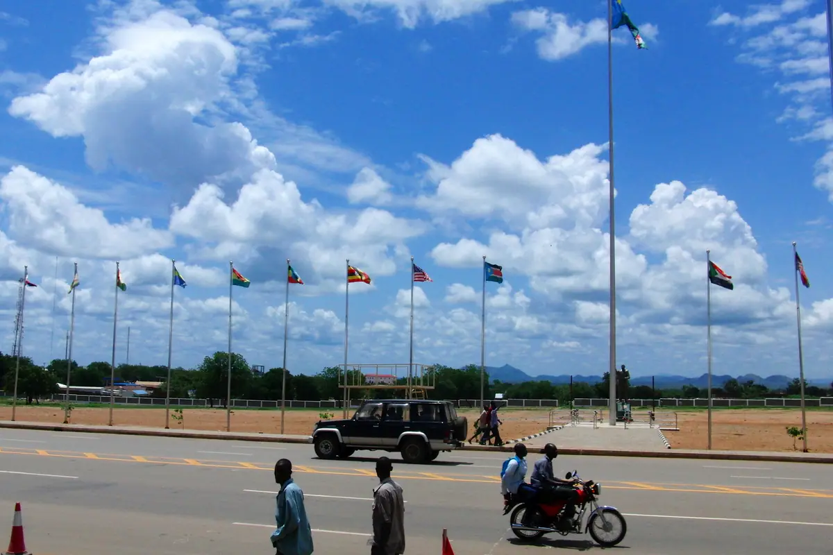
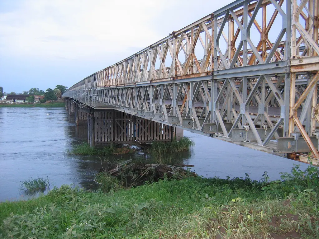
Almost every journey into South Sudan begins in Juba, a low-rise capital spread across the west bank of the White Nile where the river bends around granite outcrops. Start with the John Garang Mausoleum on the road in from the airport: a monumental tomb and memorial to the country's founding leader, set in landscaped gardens with a perpetual flame and a calm that feels a world away from the surrounding traffic. From there, walk or drive to the Juba Nile Bridge, the old steel span that carries the city across the water. Late afternoon is the time to be here, when fishermen pole dugout canoes home and the light goes copper over the river.
The city's other essential stops are its markets and churches. Konyo Konyo Market is the sprawling heart of everyday Juba — sacks of sorghum and sesame, dried Nile fish, cassava, tropical fruit, shea butter, second-hand clothing and hand-woven baskets, all under corrugated roofs and a wall of noise. Nearby, St. Teresa's Cathedral and All Saints Cathedral are both worth a look for their architecture and their role in a country where faith and community life are tightly woven together. If you're in town around Independence Day in early July, the Nyakuron Cultural Centre hosts drumming, dance and music performances that pull together traditions from across the country's many peoples.
Set aside half a day for Jebel Kujur, the rocky hill rising behind the city. The climb takes roughly thirty to forty-five minutes at a steady pace and ends at radio masts with a sweeping panorama of Juba, the Nile and the green plain beyond — go at first light before the heat builds. A few kilometres north along the river lies Gondokoro, once a major nineteenth-century trading station and steamer port; little remains but the site itself carries real historical weight. Two or three days in Juba is enough to see the highlights and organise permits and supplies before heading further afield.
Boma National Park and the Great Migration
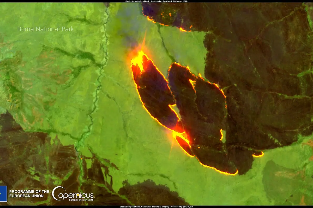
Boma National Park, in Jonglei State close to the Ethiopian border, is the reason many wildlife travellers make the journey at all. Covering well over twenty thousand square kilometres of grassland, seasonal floodplain, woodland and escarpment, it was set aside as a protected area in the early 1980s and remains almost entirely undeveloped — no lodges, no fences, no signposts. What it does have is animals: white-eared kob, tiang, Mongalla gazelle, reedbuck, buffalo, elephants, lions, wild dogs and cheetah, moving across a landscape shared with Nuer and Murle cattle-keeping communities.
The park's defining spectacle is the seasonal movement of white-eared kob and tiang, a shifting tide of hundreds of thousands of antelope that is often described as one of the largest land mammal migrations anywhere in Africa, second only to the great herds of East Africa. In the wet months the animals scatter widely across the floodplains; as the water retreats, usually between January and April, they concentrate around remaining water sources and grazing, and that is when the herds are at their most dramatic. Numbers rise and fall with rainfall and poaching pressure, so treat any figure you hear as an estimate rather than a promise.
Reaching Boma is the real undertaking. There are no reliable all-weather roads, so most visitors fly in on a light charter aircraft to a dirt airstrip, or attempt the long overland route from Juba via Bor when the ground is dry. Access is normally arranged through a local operator who handles permits, vehicles, fuel, food, camping equipment and armed escorts where required. Bandingilo National Park, which fills the corridor between Juba and the Boma landscape, holds big herds of its own and can be visited on the Juba–Bor road in the dry season. The window for all of it is short: December through March, before the rains turn the black cotton soil into a trap.
The Sudd, Lake No and Shambe National Park
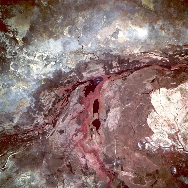
The Sudd is South Sudan's other great wilderness, and it is almost impossible to overstate its scale. Where the White Nile slows and spreads across an almost perfectly flat basin, it breaks into a labyrinth of channels, lagoons, papyrus beds and floating islands of vegetation that together form one of the largest inland wetlands on the planet. Lake No, where the Bahr el Ghazal meets the Bahr el Jebel to become the White Nile, is the classic reference point — a wide, still expanse fringed with reeds and alive with birdlife.
Wildlife here is measured differently to a savanna park. Look for shoebill storks standing motionless in the papyrus, Nile lechwe and sitatunga wading through shallow grass, hippos in loose pods, and Nile crocodiles on every sandbar. Bird numbers are extraordinary — pelicans, storks, herons, egrets, kingfishers and African fish eagles — and the sense of moving through a drowned forest of reeds is unlike anything else in the region. Shambe National Park, on the eastern bank, protects a strip of riverine forest and floodplain that shelters antelope, monkeys and a rich bird community.
Access is by boat, usually arranged from Bor or from settlements near Shambe, with overland approaches possible only in the driest months. Expect slow progress, no facilities of any kind, intense mosquitoes at dusk, and the need to carry fuel, water and food. December to March is the realistic window for most visitors. Further north along the river, the small town of Kodok — the historic Fashoda — sits near the site of the 1898 standoff between British and French colonial columns, and still holds a few faded colonial-era buildings and a frontier atmosphere.
Nimule National Park and the Fula Rapids
Roughly 190 kilometres south of Juba, pressed against the Ugandan border, Nimule National Park is the most accessible piece of proper wilderness in the country. Established in the 1950s, it protects a stretch of the Nile where the river narrows and runs through rocky gorges, flanked by riverine forest and open grassland. Elephants move back and forth across the border with Uganda's protected areas, and the park is one of the few places in South Sudan where a straightforward game drive or riverbank walk can turn up large mammals.
The standout natural feature is the Fula Rapids, a run of white water and rock islands upstream of Nimule town that is at its most forceful in the dry season. The surrounding banks are excellent for hippos, crocodiles and water birds, and the river views alone justify the trip. Nimule town itself has a lively border market and a few riverside spots where you can eat grilled fish and watch the current go by.
Practically speaking, allow three to four hours for the drive from Juba in dry conditions and considerably longer after rain, when the road degrades badly. Park entry fees and a guide are arranged on arrival or in advance, and game drives and guided walks are the main activities. The best months are December to March. Because the park sits right at the border crossing, it combines easily with onward travel into northern Uganda.
Mundari Cattle Camps at Terekeka
About 75 to 90 kilometres north of Juba along the Nile, the small town of Terekeka sits at the centre of Mundari country. The Mundari are cattle keepers above all else, and their camps on the river flats are among the most striking cultural scenes in Africa. Long-horned zebu cattle are the measure of wealth, identity and family history here, and at dawn the herds are brought to the water in clouds of dust while men and boys massage ash from burnt dung into the animals' hides and their own skin — a ritual that protects against insects and turns both people and cattle a ghostly blue-grey in the low light.
If you want to visit, go with a local guide who has a genuine relationship with the community, and treat the whole experience as a visit rather than a photo shoot. Ask before photographing anyone, accept that some requests will be declined, and expect the practical arrangements and any contributions to be discussed with elders in advance. The dry season, roughly December through April, is the right time: the camps are out on the open flats, the roads are passable, and the light at sunrise and in the late afternoon is spectacular.
A day trip from Juba is possible in the dry season, but an overnight stay gives you the dawn and dusk hours that make the journey worthwhile. There are no facilities, so bring your own water, food and fuel, and be prepared for a rough ride on the final stretch. The same cattle-keeping culture appears in different forms among Dinka and Nuer communities throughout the Nile corridor, and it remains the most vivid window into how most South Sudanese live.
The Imatong Mountains and the Green South
In Eastern Equatoria, the Imatong Mountains rise sharply out of the plains, culminating in Mount Kinyeti at roughly 3,187 metres — the highest point in South Sudan. This is a different country entirely from the northern floodplains: cool montane forest, tumbling streams and waterfalls, terraced hillsides and mist that hangs in the valleys until mid-morning. The usual approach is through Torit and then rough tracks towards Kiyala and the Kidepo valley on the Ugandan border, a route that demands a sturdy vehicle and a driver who knows it.
Hiking to Kinyeti and the surrounding peaks is a multi-day undertaking with local guides and porters, camping along the way. Birdlife is superb — turacos, barbets and forest species that rarely show themselves elsewhere in the country — and the mountain air is a relief after weeks of lowland heat. The driest months, December to February, are easiest, though the range catches rain for much of the year and stays lush and green even in the dry season.
Further west, Western Equatoria around Yambio offers yet another landscape: dense tropical rainforest, heavy rainfall, and the culture of the Zande people, with game reserves such as Bangangai protecting forest antelope, monkeys and rich bird communities. Roads here are the most difficult in the country during the rains, and travel is best timed to the short dry spells. Together with the Imatong highlands, this green southern belt is the part of South Sudan that surprises visitors most — and the part that stays with them longest.
Frequently asked questions
When is the best time to visit South Sudan?
The dry season from December to March is by far the easiest window: roads hold, wildlife concentrates around water, and the cattle camps are out on the open river flats. The antelope migration in the Boma and Bandingilo landscape is generally at its peak between January and April. From roughly June to October the rains make much of the interior — especially the black cotton soil of the Sudd margins and Equatoria — genuinely impassable.
Do I need a visa and special permits?
Yes. Arrange your visa in advance, and be ready to show a yellow fever vaccination certificate on arrival. Travel outside Juba almost always requires permits arranged through the relevant state authorities, which is normally handled for you by a local operator. Carry several photocopies of your passport, visa and permits, and expect checkpoints on most intercity routes.
Is it safe and how should I travel?
Check your government's current travel advice before booking, as conditions vary enormously between regions and can change quickly. Travel with a reputable local operator and guide, avoid border zones and areas of active conflict, never drive at night, and be aware that landmines and unexploded ordnance remain a concern in parts of Equatoria and some border areas. Going with people who know the ground is not optional here — it is the single most important decision you will make.
How do I get there and around?
Juba International Airport is the main gateway, with connections via East African, North African and Gulf hubs. Domestic travel is by light charter aircraft — the practical way to reach Boma and other remote parks — or by 4x4 with a driver-guide on dirt roads that are slow and seasonal. Boats are the only sensible transport in the Sudd. Build in extra days for delays; schedules are weather-dependent and flexible by necessity.
What should I pack and know about health?
Bring malaria prophylaxis, a yellow fever certificate, a comprehensive first-aid kit, water purification tablets or a filter, high-factor sun protection, a hat, long sleeves and trousers for evenings, and sturdy boots. Binoculars are essential. Cards are rarely accepted outside a handful of places in Juba, so carry enough cash in South Sudanese pounds for the whole trip, plus a generous contingency. Patience, flexibility and a sense of humour will serve you better than any piece of gear.
Plan it — experiences in South Sudan
Live search, booked directly with trusted providers.
Sort the rest of your trip
Everything for South Sudan, in one place
Stay in South Sudan
Hotels, guesthouses and apartments — compared in one search.
Search hotels
Transfer in South Sudan
Private driver waiting on arrival — no queues, no surprises.
Book a transfer
Stay online in South Sudan
Travel eSIM — data the moment you land, no roaming bills.
Get an eSIM