Namibia is a country that rearranges your sense of scale: a coastline of fog and shipwrecks, a plateau of salt that glows white under a hard blue sky, and dunes that turn from apricot to blood-orange in the twenty minutes after sunrise. This is a self-drive country of long gravel roads and very few people, where the reward for a 300-kilometre day is often a waterhole, a canyon rim or a dead tree standing in white clay.
Sossusvlei and Deadvlei: The Red Heart of the Namib
The road into the Namib-Naukluft begins at Sesriem, and the rule everyone learns on their first morning is simple: be at the gate before it opens. From there it is roughly 60 kilometres of tar and gravel to Sossusvlei, past Dune 45 — the most photographed dune in the country, and the one most travellers climb barefoot before the sand heats up. The final stretch across soft sand usually needs a 4x4 or the shuttle that runs from the car park, and beyond it lie the two sights that define Namibia in most people's imaginations.
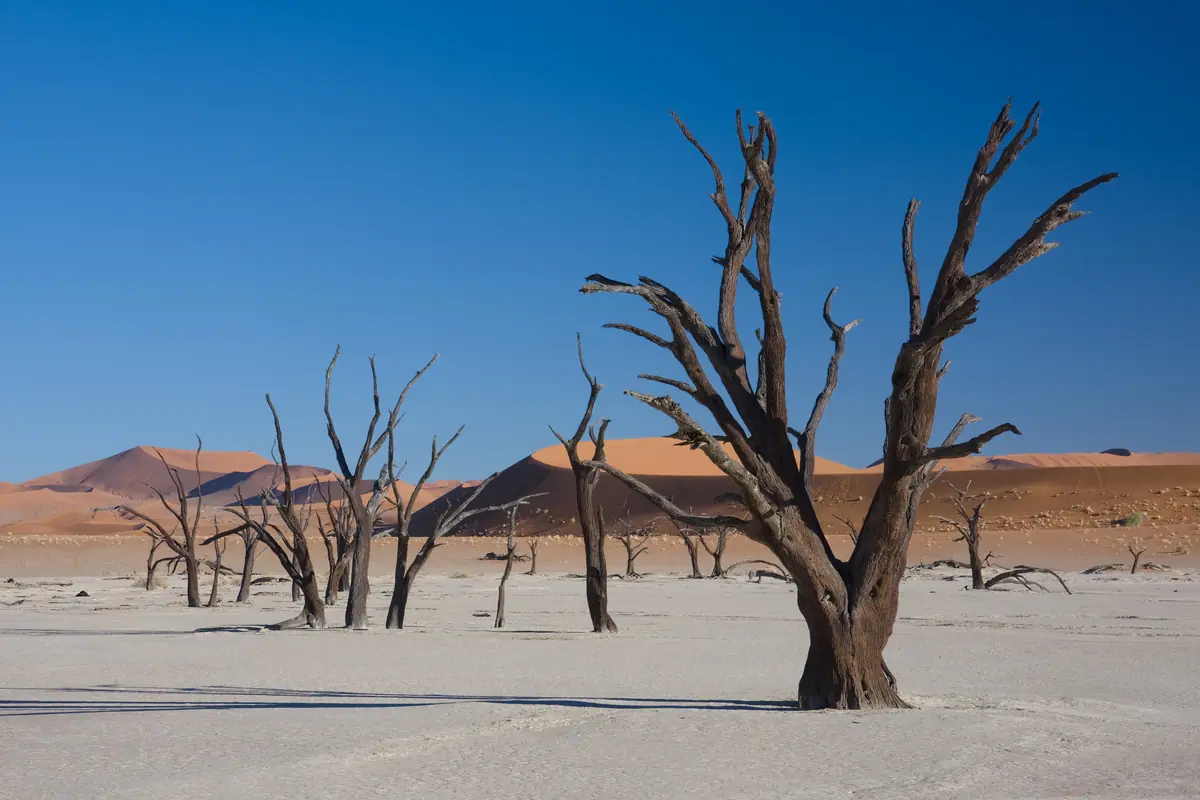
Deadvlei is the one that stops conversation. A white clay pan ringed by some of the tallest dunes on earth, scattered with blackened camelthorn skeletons that have stood for centuries because there is not enough moisture left in the air to rot them. The contrast — ivory ground, charcoal wood, rust-red dune wall, cobalt sky — is at its most intense in the first hour of light and again in the last. Climb Big Daddy or the smaller ridge beside it for the classic view down over the pan, then walk across the crust to stand among the trees.
Sossusvlei is at its best from May to September, when days are warm rather than punishing and nights turn genuinely cold. October and November bring oven-like heat and shimmering air. Most visitors base themselves either inside the park at Sesriem, which buys you the crucial early start, or at one of the lodges strung along the road outside the gate. Do not skip Sesriem Canyon, a narrow, shaded gorge cut into the plateau a few minutes from the camp, and Elim Dune, which is the easiest place to watch the sun go down with almost nobody else around.
Etosha National Park: Waterholes and the Great White Pan
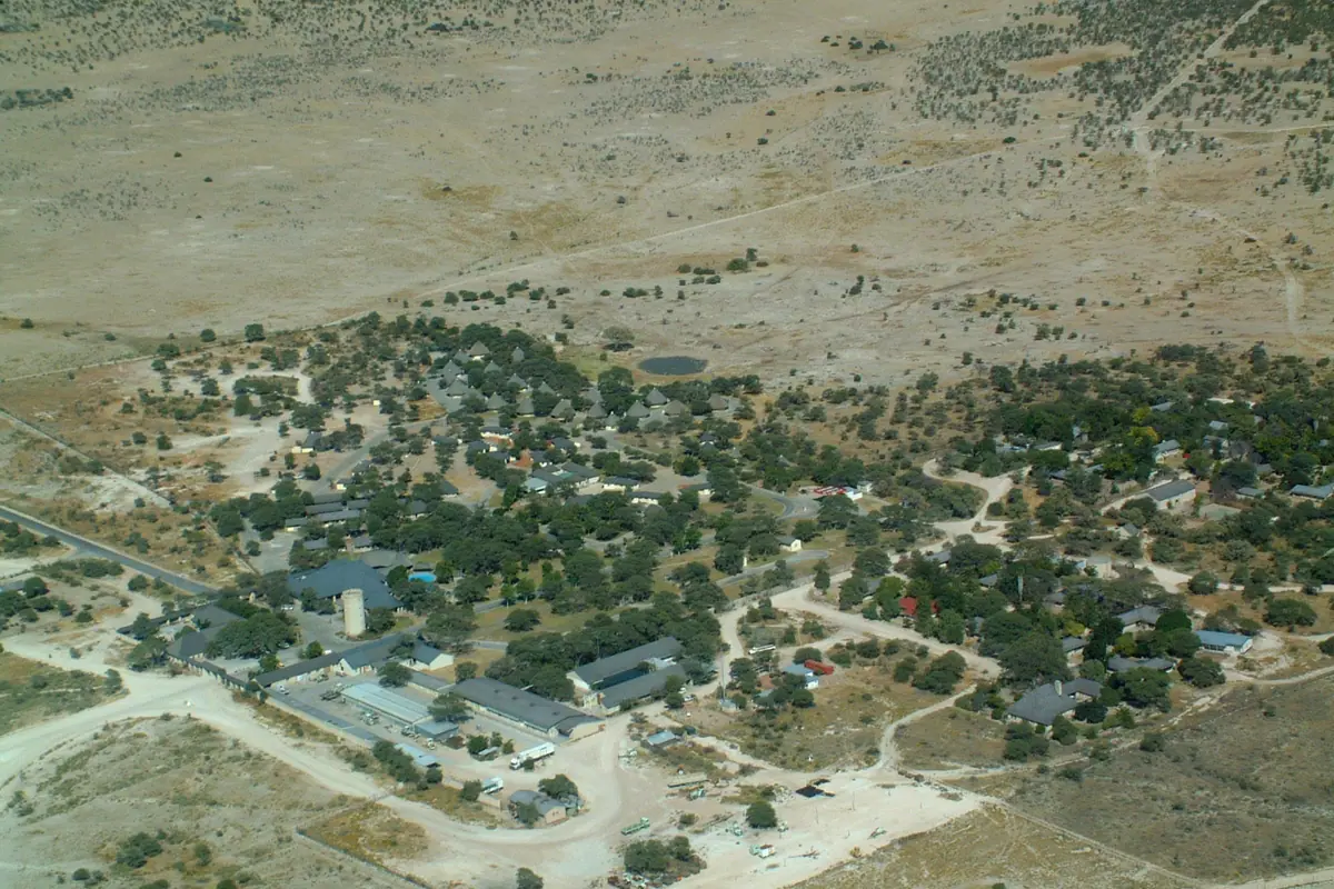
Etosha means 'great white place', and the name describes the vast mineral pan at its centre — a shimmering, cracked expanse so large that it shapes the weather and the movement of every animal in the park. Around its edges, roughly 22,000 square kilometres of mopane scrub, grassland and thornveld support one of the densest concentrations of wildlife in southern Africa, including elephant, black rhino, lion, leopard, cheetah, giraffe and dozens of antelope species.
The park's genius is its waterholes. In the dry months, from roughly June to October, surface water disappears from the bush and animals are forced to drink at a limited number of points, many of them floodlit and overlooked by camp benches. Sitting quietly at Okaukuejo after dark and watching rhino, elephant and lion arrive one after another out of the dark is the signature Etosha experience. Halali and Namutoni offer the same ritual in quieter settings, and the network of gravel loops between them means you can spend a whole day driving between waterholes without ever feeling crowded.
The green season, from December through March, flips the park entirely: the pan holds shallow water, flamingos and pelicans appear, migrant birds arrive in numbers, and the bush turns thick and emerald, which makes animals harder to spot but the landscape far more beautiful. Whichever season you choose, plan on at least two nights inside the park and drive slowly — the best sightings usually happen at 15 kilometres an hour. Namutoni's fort-style camp in the east and the private reserves fringing the southern boundary make good additions if you want night drives and walking safaris, which are not permitted inside the national park itself.
Fish River Canyon and the Deep South
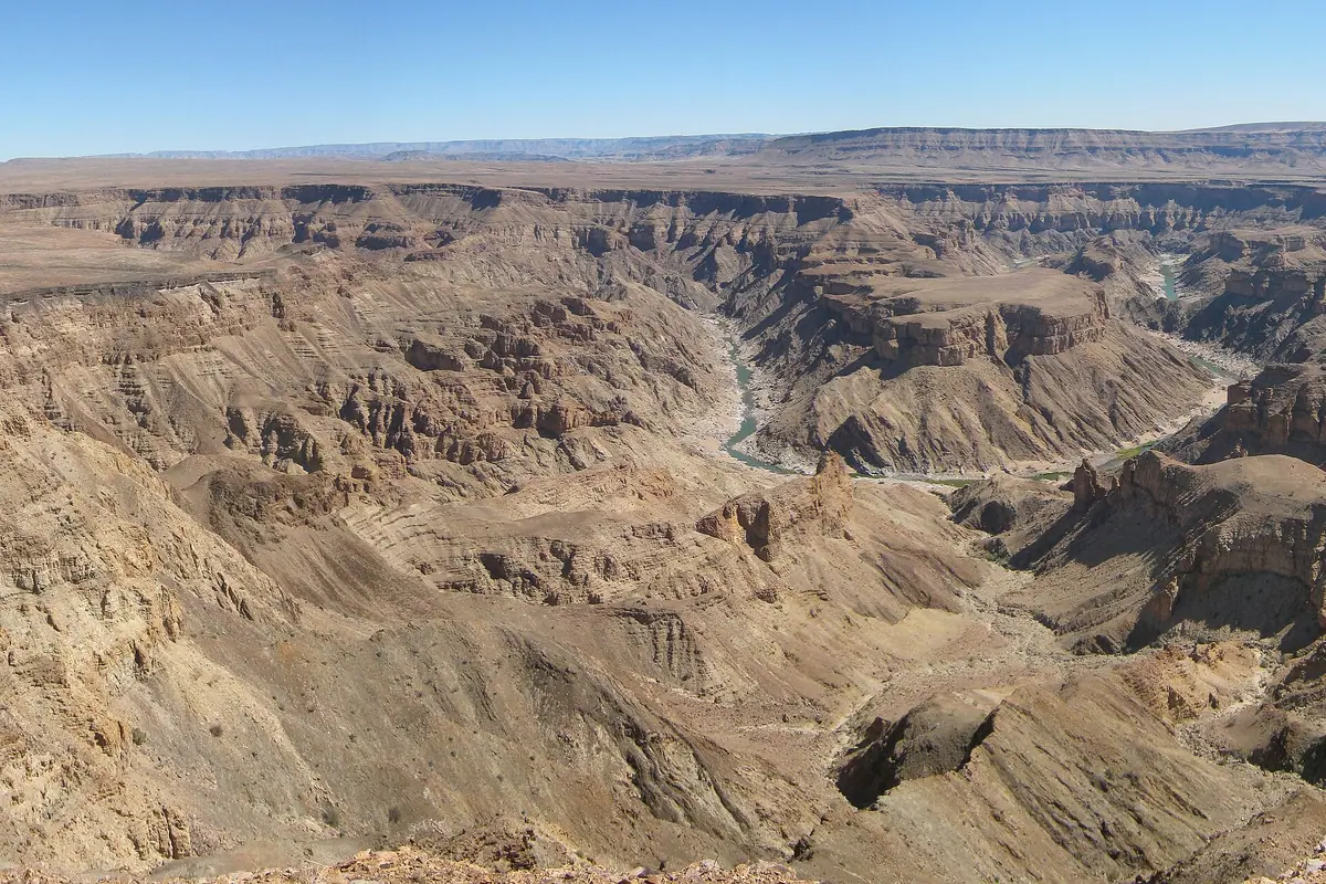
Far to the south, the Fish River has spent hundreds of millions of years carving a gash across the plateau that is often described as the largest canyon in Africa and among the biggest anywhere. It runs for around 160 kilometres, dropping to depths of more than 500 metres in places, and the viewpoints near Hobas give you that dizzy, tilted-horizon feeling that no photograph quite captures. Sunset from the main lookout, with the river a thin green thread on the canyon floor, is worth the long drive.
For serious hikers, the five-day Fish River Canyon trail is one of southern Africa's great treks: roughly 85 kilometres of boulder-hopping, sand and riverbed, run only in the cooler months between May and September, with limited permits and a compulsory medical certificate. Everyone else can enjoy the canyon from the rim, then continue south to the hot springs at Ai-Ais, where warm mineral water bubbles out of the rock at the bottom of the gorge — a wonderful antidote to days of driving.
The deep south rewards those who linger. Near Keetmanshoop, a forest of quiver trees stands on a rocky ridge, their forked branches silhouetted against the stars. Further west, close to the coastal town of Lüderitz, the abandoned diamond settlement of Kolmanskop is slowly filling with sand: grand houses, a ballroom and a hospital half-buried in dunes, visited on guided tours that explain the extraordinary boom and bust behind it. The roads here are long and lightly travelled; fuel up whenever you can, carry water, and never assume the next settlement has a working pump.
Skeleton Coast and Damaraland: Shipwrecks, Seals and Ancient Art
The Skeleton Coast is exactly as romantic and as hostile as its name suggests: a cold, fog-bound shore littered with whale bones and the rusting remains of ships that misjudged the currents. The southern section is accessible by self-drive through the Ugab gate, where you can walk the beaches and see the salt pans and dunes pushing right down to the surf. Further north, the coast becomes a series of private concessions reachable only by light aircraft, where the silence is broken only by wind and the cry of gulls.
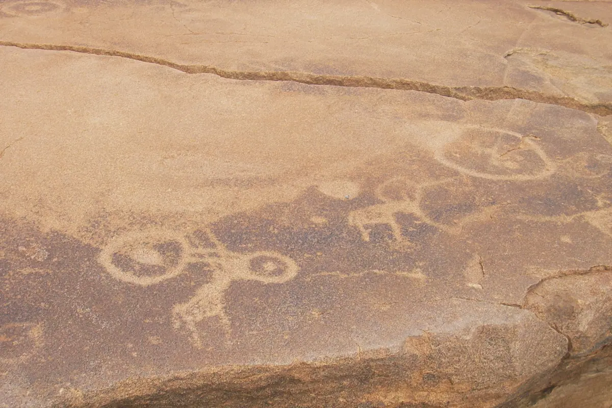
Wildlife concentrates where the cold Benguela current feeds the sea. At Cape Cross, a huge colony of Cape fur seals sprawls across the rocks — loud, pungent and utterly mesmerising, with jackals patrolling the edges. Inland, Damaraland is a different world of granite outcrops and dry riverbeds. Twyfelfontein holds one of the finest collections of rock engravings in Africa, pecked into sandstone slabs by San hunter-gatherers and recognised as a World Heritage site. Nearby are the Organ Pipes, a wall of geometric basalt columns, and the Burnt Mountain, whose dark, scorched-looking slopes glow red in late light.
Damaraland is also the place to look for desert-adapted elephants and black rhino, usually with a local conservancy guide who knows the herds and the water points. The Spitzkoppe, a vast granite peak rising abruptly from the flat plain, is a magnet for photographers and climbers, while the Brandberg massif — Namibia's highest mountain — shelters the famous White Lady rock painting, reached on a hot but rewarding walk with a local guide. Community campsites and guided activities here put money directly into the areas you are travelling through.
Swakopmund and Walvis Bay: Where the Desert Meets the Atlantic
Swakopmund feels like a small German seaside town dropped onto the edge of the Namib: pastel colonial buildings, a long wooden jetty reaching into the surf, a lighthouse, a palm-lined promenade and a pervasive chill in the air even in midsummer. It is the country's adventure capital, and the contrast is the appeal — you can sandboard or quad-bike down a dune in the morning and eat seafood overlooking the breakers in the evening.
To the south, Walvis Bay shelters a broad lagoon that is one of the most important wetlands in southern Africa, packed with flamingos, pelicans and wading birds. Boat trips out into the bay regularly meet dolphins, seals and, in season, whales, while kayaking from Pelican Point puts you at eye level with curious seals. The four-wheel-drive excursion to Sandwich Harbour, where towering dunes plunge directly into the sea, is the standout half-day trip on this coast and needs a proper guide and a proper vehicle.
Give yourself two or three nights here. The cool, foggy weather is a relief after the interior, the seafood is the best in the country, and the excursions — including flights over the coast and the desert, and the strange, otherworldly landscapes of the Moon Valley and the Welwitschia plains — are genuinely worth the time. From Swakopmund it is a comfortable drive north to Cape Cross, or east back towards the interior on good tar roads.
Windhoek, the Central Plateau and the Far North
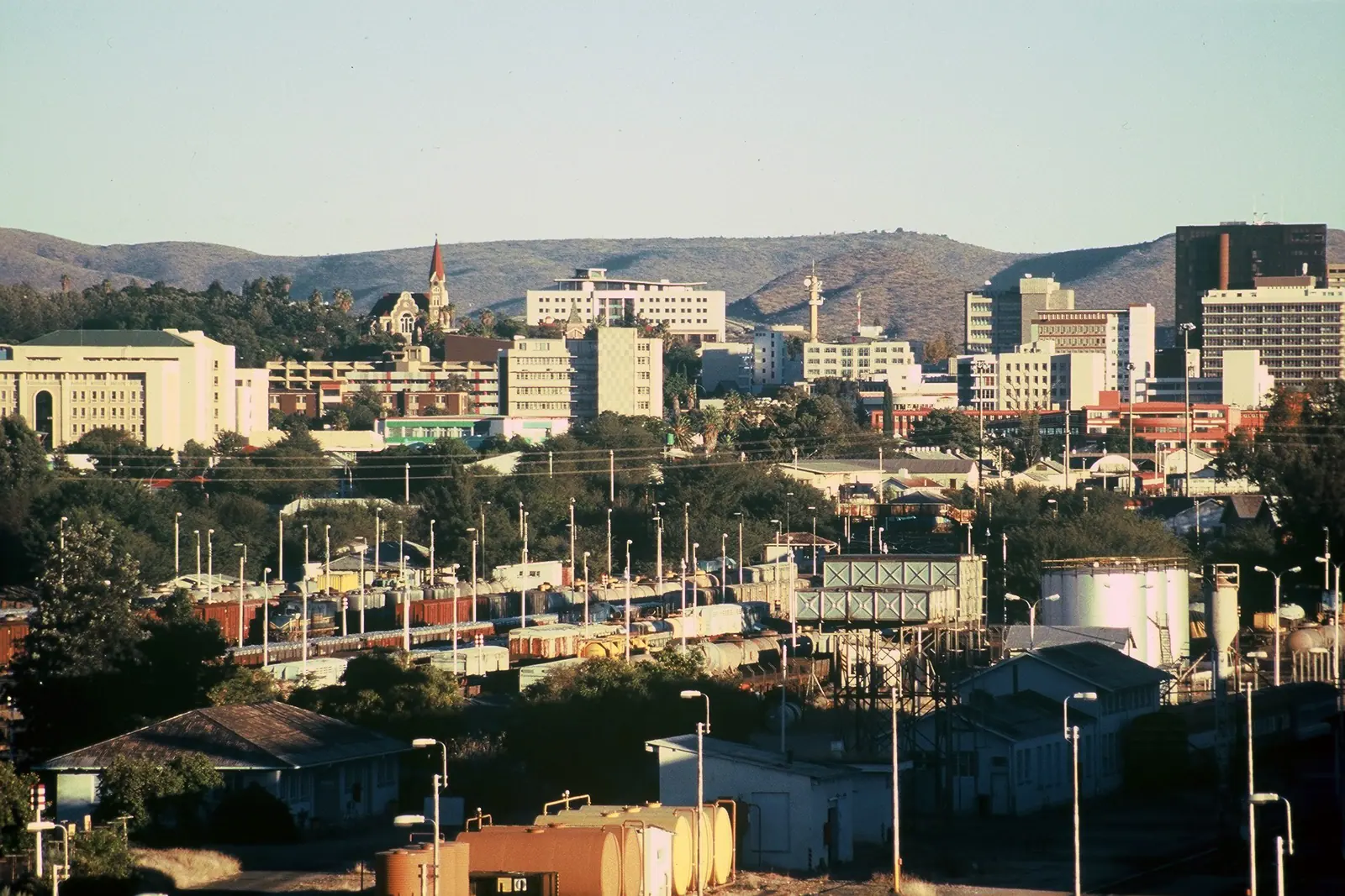
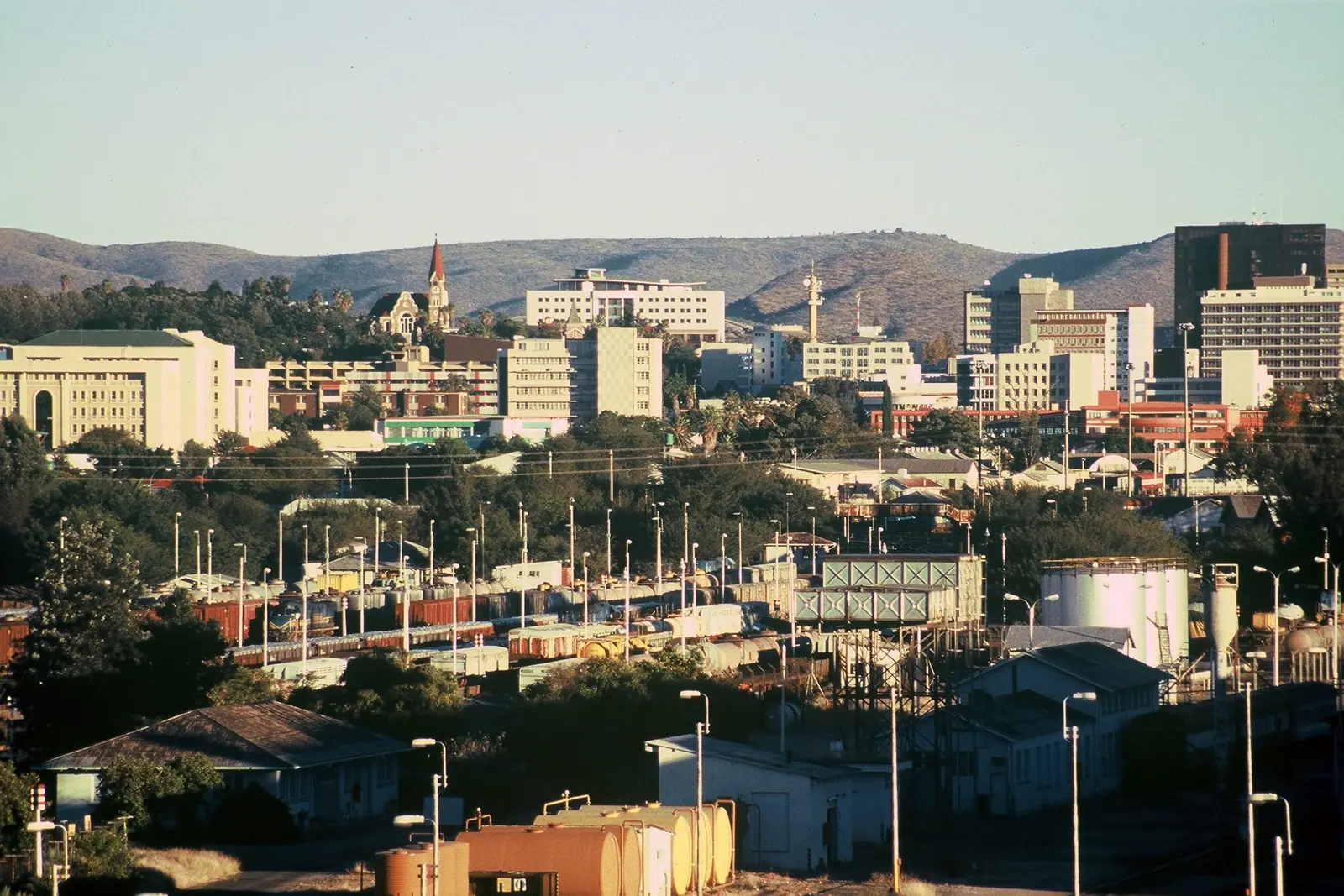
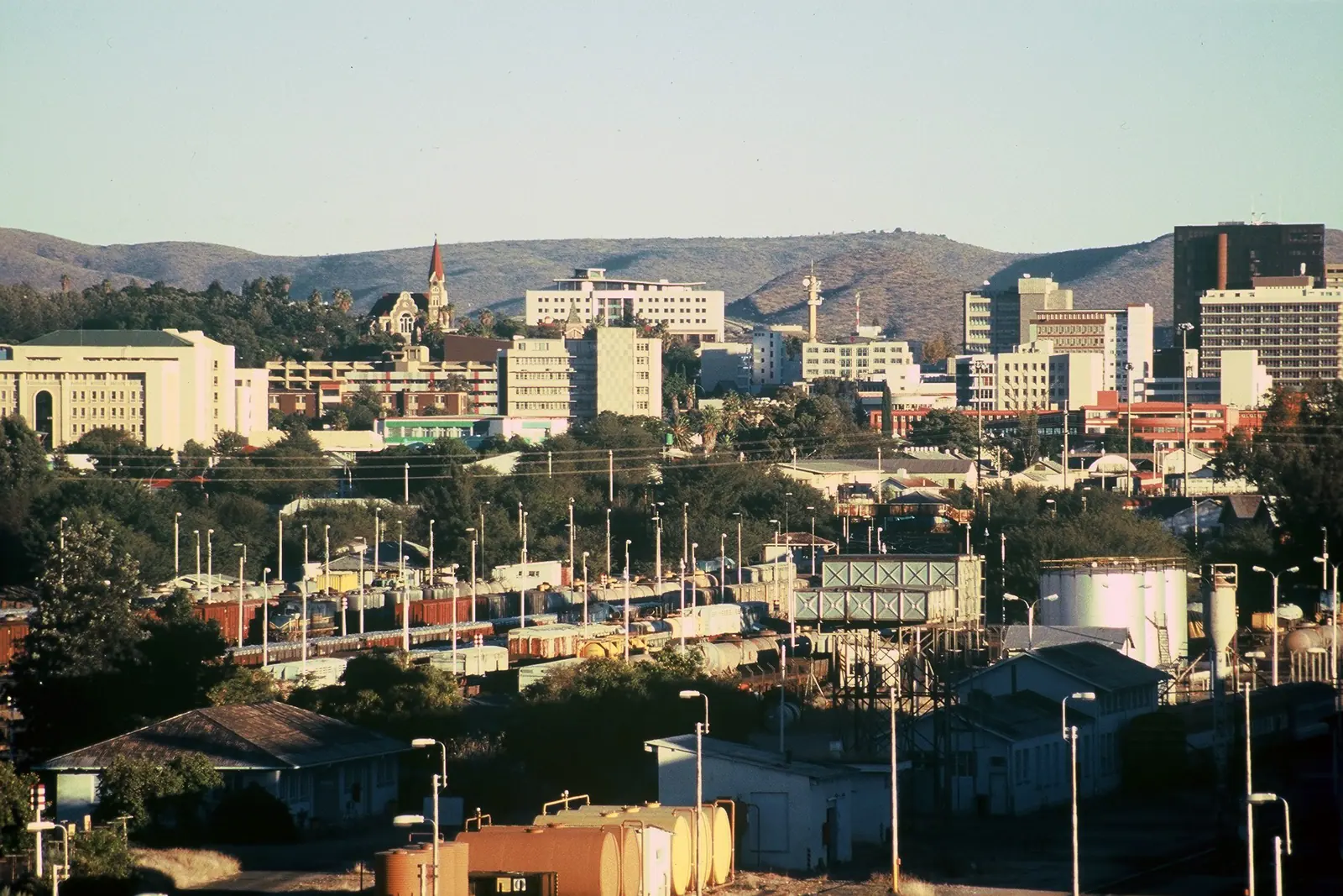
Most journeys begin and end in Windhoek, a compact capital set in a bowl of hills. Its landmarks are easy to cover in a day: the Christuskirche with its sandstone spire, the old fort and Tintenpalast nearby, the Independence Memorial Museum with its sweeping view over the city, and the lively craft and food markets where you can stock up on supplies before heading out. It is also the place to sort out a vehicle, buy a local SIM card and stock a proper medical kit before the long roads begin.
North of the capital, the Waterberg Plateau rises in sheer red cliffs above the bush, offering short walks, rhino tracking and wonderful views. Further north again, the country opens into communal conservancies, cattle posts and mopane woodland, and the scenery shifts towards the Kunene River and the thundering Epupa Falls, where baobabs and palms crowd the water's edge. The Zambezi and Okavango regions, including the wildlife-rich Bwabwata and Mahango areas, are a completely different Namibia of rivers, papyrus and birdlife, best visited in the dry winter months when the tracks are firm.
Plan your route around distances rather than attractions. A classic two-week self-drive loop — Windhoek, Sossusvlei, Swakopmund, Damaraland, Etosha and back — covers around 3,000 kilometres, much of it on gravel. Drive in daylight, keep your fuel tank above half, carry at least four litres of water per person per day, and remember that the dry winter from May to September is the most reliable time for wildlife and comfortable driving, while the green season delivers dramatic skies, newborn animals and superb birding.
Frequently asked questions
What is the best time of year to visit Namibia?
The dry winter months from May to September are the most popular: clear skies, cool nights, warm days and excellent wildlife viewing because animals concentrate at waterholes. October and November are very hot before the rains break, while December to March brings green landscapes, dramatic thunderstorms, newborn animals and outstanding birdwatching, though some tracks in the north become muddy.
Do I need a 4x4 to travel around Namibia?
Not everywhere. The main routes between Windhoek, Swakopmund, Etosha and Sossusvlei are tarred or good gravel and can be driven in a normal car in dry conditions. A 4x4 is genuinely useful for the last stretch into Sossusvlei, for Sandwich Harbour, for remote Damaraland tracks and for the river regions in the north, especially after rain.
How many days do you need in Namibia?
Ten days is the minimum for a comfortable loop covering Sossusvlei, Swakopmund and Etosha. Two weeks allows you to add Damaraland, Spitzkoppe or the Waterberg without rushing, and three weeks opens up the far south around Fish River Canyon and the northern rivers. Distances are large, so avoid trying to see everything in one trip.
Is Namibia safe for self-drive travellers?
It is one of the more straightforward countries in Africa to self-drive, with light traffic outside the capital. The main risks are gravel-road speed, wildlife and livestock on the road at dusk, and long distances between fuel stops. Drive only in daylight, reduce speed on gravel, carry spare water and tyres, and let someone know your route where phone signal is patchy.
Can you visit Sossusvlei and Etosha in the same trip?
Yes, and many travellers do. The drive from the Sesriem area to Etosha's southern gate takes the better part of two days, usually broken with a night or two in Swakopmund or Damaraland. Booking accommodation inside Etosha and at Sesriem well in advance is essential for the high season between June and September.
Plan it — experiences in Namibia
Live search, booked directly with trusted providers.
Sort the rest of your trip
Everything for Namibia, in one place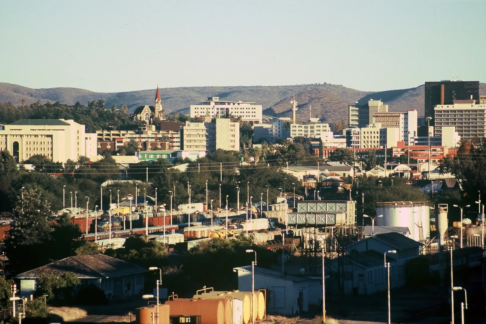
Stay in Namibia
Hotels, guesthouses and apartments — compared in one search.
Search hotels
Transfer in Namibia
Private driver waiting on arrival — no queues, no surprises.
Book a transfer
Stay online in Namibia
Travel eSIM — data the moment you land, no roaming bills.
Get an eSIM