Mauritania is the Sahara at its most elemental: ochre dunes, slate-black plateaus, a bird-haunted Atlantic shoreline and caravan towns where hand-copied manuscripts still live in family libraries. It is not a country of polished resorts but of long 4x4 drives, cold desert nights and sudden moments of astonishment. These are the stops that reward the effort.
Chinguetti, Ouadane and the Caravan Cities of the Adrar
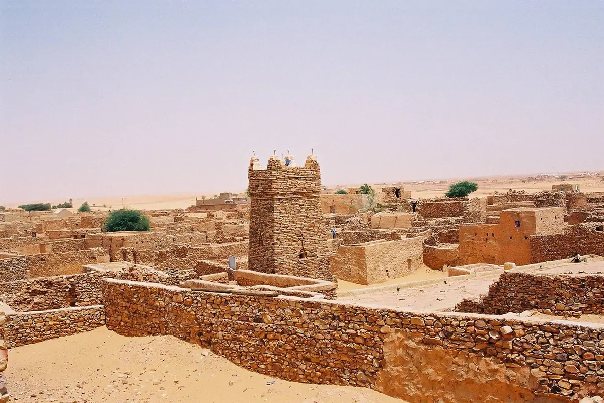
Chinguetti is the image most travellers carry home. Founded as a desert trading post and later a gathering point for pilgrims heading east, it grew into one of the western Sahara's great centres of learning. Its Friday Mosque, with a square dry-stone minaret studded with protruding wooden beams, rises above a jumble of flat-roofed houses half swallowed by sand. Around it, families keep private manuscript collections — astronomy, medicine, law, poetry and finely illuminated Qur'ans copied by hand centuries ago — and several of these libraries open their doors to visitors who ask politely through a local guide. Budget half a day for the mosque, one or two libraries and the old quarter's date-palm gardens.
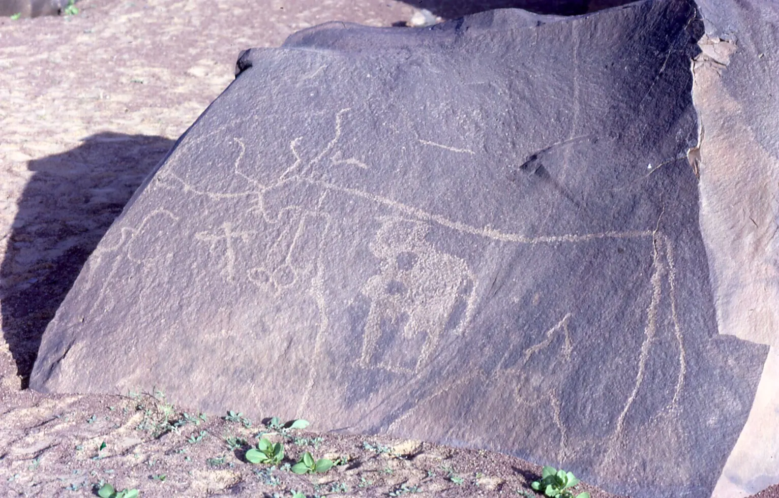
Ouadane, some 120 kilometres northeast of Atar, is the more dramatic ruin. Its ksar clings to a rocky spur above a green slash of palms, with roofless stone houses, a small mosque and the remains of a fortified trading post from the era when caravans carried salt and gold across the Sahara. Climb to the upper gateway for sunset, when the sandstone turns copper and the desert beyond fades into haze. Azougui, closer to Atar, was an 11th-century Almoravid settlement; today low walls, a mihrab and a scatter of stones mark where a mosque and garrison once stood, with Neolithic rock carvings in the surrounding hills.
The Adrar is the easiest Saharan region to explore, and Atar is its natural base, with vehicle hire, drivers and simple guesthouses. Distances are small by Mauritanian standards — Atar to Chinguetti is around 90 kilometres, Atar to Ouadane around two hours on a good day — but roads are often rough tracks and journeys take longer than maps suggest. Visit between November and February, when daytime temperatures sit in the twenties and nights are genuinely cold. In March the heat begins to bite, and by May the desert is punishing.
The Richat Structure and the Wild Landscapes of the Adrar Plateau
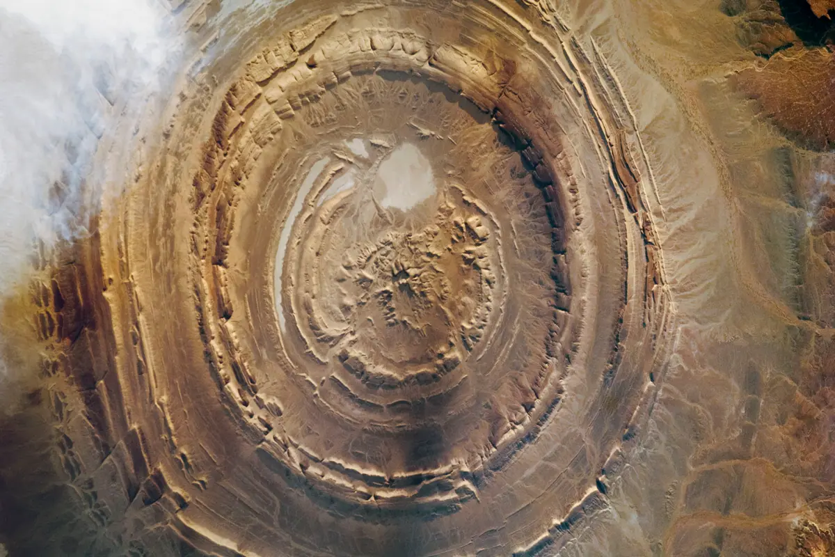
The Guelb er Richat, known worldwide as the Eye of the Sahara, is a set of concentric rings roughly 40 kilometres across, cut into the plateau northwest of Ouadane. Seen from orbit it looks like a bullseye; seen from the ground it becomes a strange, silent landscape of quartzite ridges, gravel plains and fossil-bearing limestone. A viewpoint beside the Atar–Ouadane road gives a sense of the inner circles if you climb a low ridge, though the full pattern only resolves from the air. There are no facilities, no shade and no barriers — just a 4x4, plenty of water, and the best light in the first hours after sunrise.
The Adrar's smaller wonders are just as memorable. Terjit Oasis is a narrow canyon where a spring feeds pools of cool water beneath a canopy of palms and tamarisk; a rudimentary campement allows overnight stays, and it is the single best place in the country to swim in the desert. Nearby, the Amogjar Pass winds between dark cliffs and a ruined hilltop fort, and the rocks carry Neolithic paintings of giraffes, cattle and hunters — a reminder that this was once savannah. Bring a torch for the shaded panels and go with someone who knows which turnings hide them.
Further north, between the iron-mining town of Zouérat and the coast, the monolith of Ben Amera rises hundreds of metres from an otherwise flat plain. It ranks among the largest single rocks on Earth, and standing at its base is genuinely humbling. Kediet ej Jill, near Zouérat, is the country's highest point, a dark, iron-rich massif so magnetic that compasses fidget. Both are difficult, rewarding detours that need their own logistics: long days of driving, fuel planning and a vehicle in good condition.
Banc d'Arguin National Park: Sandbanks, Seabirds and the Imraguen
Stretching for around 12,000 square kilometres between Nouakchott and Nouadhibou, Banc d'Arguin is where the Sahara meets one of the richest marine nurseries in West Africa. Shallow seagrass meadows, tidal mudflats and the islands of Tidra, Niroumi and Kijji form a wintering ground of staggering scale: hundreds of thousands of shorebirds, flamingos, pelicans, terns, waders and gulls, many of them arriving from Arctic and European latitudes between November and March. The park is a globally important stopover on the coastal migration route, and the birds are so unused to people that they let boats drift remarkably close.
The park is also home to the Imraguen, fishing communities who work from sail-powered wooden boats and traditionally drove mullet into their nets with the help of dolphins. Villages such as Iwik and Mamghar take in a trickle of visitors, offering simple campements, fish grilled over coals and tea poured from height. Staying overnight is the point: the light at dawn and dusk over the flats is extraordinary, and the silence is broken only by wind and birds.
Visitors must arrange a park permit and a licensed guide in Nouakchott before setting out, and travel is by 4x4 only, along sandy tracks that shift with the wind. Tides dictate the route, so plan with local advice and allow a full day simply to reach Iwik from the capital. Carry all water, fuel, food and cash with you, protect against sun and sandflies, and expect no mobile coverage in much of the park. Independent wandering is not permitted inside the protected zone.
The Iron Ore Train to Nouadhibou and the Cap Blanc Seals
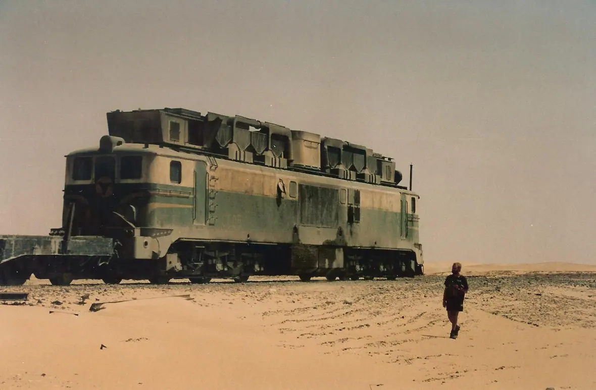
One of the world's longest trains runs 700 kilometres from the iron mines at Zouérat down to the Atlantic at Nouadhibou, hauling more than 200 wagons loaded with ore. Riding it is a Mauritanian rite of passage: travellers clamber into an empty hopper wagon, wrap up against the night cold, and wake after roughly 20 hours to a dust-orange sunrise over the coast. It is not comfortable, not officially a passenger service and not something to improvise — you need current local information on departure times, permission, a dust mask, goggles, warm layers and a great deal of drinking water.
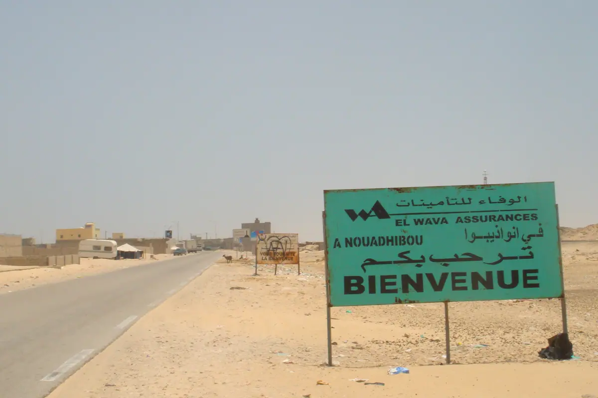
Nouadhibou itself is a scruffy, end-of-the-line port with a fine fish market and a bay full of rusting hulls. Its real distinction lies just outside town at Cap Blanc, where a colony of Mediterranean monk seals — among the rarest marine mammals on the planet, numbering only a few dozen here — hauls out on the beaches below the cliffs. Viewing is strictly from the clifftop, usually in the morning, and access is controlled by local authorities, so ask in town about current rules rather than driving out on a whim.
The peninsula is also the staging point for travellers continuing north to the Western Sahara border, and a comfortable place to recover from the train with fresh grilled fish and a cold drink. Allow two nights: one to sleep off the ore dust, one to see the seals and the port. Between November and March the coastal air is mild and pleasant; in summer the heat and humidity make Nouadhibou a tougher proposition.
Nouakchott and the Green South
Nouakchott is a sprawling, windswept capital that most travellers treat as a transit point — a mistake worth correcting with a single unhurried day. Start at the Port de Pêche, where brightly painted pirogues crowd the beach and the catch is unloaded, gutted and sold in a haze of smoke and shouting during the afternoon. Then head to the Cinquième Marché for fabrics, silver and tea equipment, browse the national museum's archaeology and manuscript collections, and finish at the camel market on the northern edge of the city, busiest in the early morning. The city's wide sandy streets and low buildings take patience, but the market theatre is authentically Mauritanian.
South and east of the capital, the desert gives way to acacia savannah and seasonal wetlands. Lac d'Aleg, near the town of Aleg on the road towards Kiffa, is one of the few permanent lakes in the country and draws pelicans, flamingos and wintering waterbirds from December to February. It is a dawn destination: by mid-morning the light flattens and the birds move on. Bring binoculars and a local contact, because the shoreline is unfenced and the tracks are soft in places.
Closer to the Senegal River, Diawling National Park protects a restored floodplain of channels, reedbeds and lagoons near Keur Macène. It is a stronghold for pelicans, cormorants, herons and flamingos, best visited by small boat with a guide between November and March, and it pairs neatly with Lac d'Aleg in a two- or three-day southern loop. Birdwatching here is genuinely world-class and almost entirely untouristed, which is precisely the appeal.
Tichitt, Oualata and the Stone Ksour of the East
In the Tagant and Hodh regions, centuries-old stone settlements sit on escarpments and dry lake beds, far from any paved road. Ksar el Barka, near Moudjéria, is a ruined 17th-century trading town on the floor of a vanished lake, its walls and mosque eroded into a maze of dark stone. Further east, Tichitt is a chain of dry-stone villages perched along a cliff, founded as a caravan and scholarly centre and remarkable for its architecture: narrow lanes, granaries and hidden courtyards built without mortar. The views over the escarpment at sunset are worth the punishing drive.
Oualata, deep in the southeast, is the most visually striking of all. Its houses are decorated with intricate geometric paintings in ochre, white and black — a tradition maintained and repainted largely by women — and the town has long been a centre of manuscript copying and Islamic scholarship. A small museum displays old texts and household objects. Reaching Oualata involves a very long journey via Néma, more than a thousand kilometres from the capital, so it suits travellers with time, a robust 4x4 and a taste for remote places.
Archaeology buffs should add Koumbi Saleh, the mounds of a medieval capital of the Ghana Empire, on the dry plains between Kiffa and Néma. There is little to see beyond low walls, burial markers and a mosque footprint spread over a wide site, so a knowledgeable local guide transforms the visit from a scatter of stones into a story. The eastern circuit runs comfortably only from November to February, when nights are cold, days are dry and the tracks are at their firmest; after summer rains, some routes become impassable.
Frequently asked questions
When is the best time to visit Mauritania?
November to February is by far the most comfortable window: mild days, cold desert nights and firm tracks across the Adrar and the eastern ksour. March to June brings intense, dry heat, with interior temperatures often far above 40°C, while July to September is the rainy season in the south, when the Senegal River delta turns green but some dirt roads become impassable. Coastal Nouadhibou and Banc d'Arguin are pleasant in the cool months and humid and hazy in high summer.
How do travellers get around Mauritania?
Distances are vast and public transport is limited, so most visitors hire a 4x4 with a driver-guide, usually arranged in Nouakchott or Atar. Key links include the capital to Atar (roughly 460 kilometres), Atar to Chinguetti (about 90 kilometres) and Nouakchott to Nouadhibou (around 470 kilometres). Expect long days, occasional checkpoints and rough pistes; carry spare fuel, water and cash, and never plan a desert leg by map distance alone.
Do I need a permit to visit Banc d'Arguin National Park?
Yes. Access to the protected area requires a permit and a licensed guide, both arranged in Nouakchott before departure, and independent travel inside the park is not allowed. You travel by 4x4 on sand tracks that change with the tides, so itineraries are usually built around a night or two in an Imraguen village such as Iwik. Bring everything you need — water, food, fuel, sun protection and cash — as there are no shops or services once you leave the tarmac.
Can you actually see the Richat Structure from the ground?
Partly. The full concentric pattern of the Eye of the Sahara only makes sense from the air, but from a ridge beside the Atar–Ouadane road you can look across the outer rings and the pale interior basin, especially in early morning or late afternoon light. It is a remote, unmarked site with no facilities, so you need a 4x4, a driver who knows the approach tracks, and plenty of water. Allow a half day from Ouadane or a long day trip from Atar.
What should I pack and know before travelling in Mauritania?
Pack loose, modest clothing that covers shoulders and knees, a headscarf, sturdy shoes, high-factor sunscreen, a wide-brimmed hat, a head torch and a dust mask for the iron ore train. Bring euros in cash to exchange for ouguiya, since international cards are rarely accepted outside the capital, and keep small notes for tips and village purchases. Alcohol is heavily restricted, tap water should not be drunk, and travel insurance covering remote desert evacuation is strongly advised.
Plan it — experiences in Mauritania
Live search, booked directly with trusted providers.
Sort the rest of your trip
Everything for Mauritania, in one place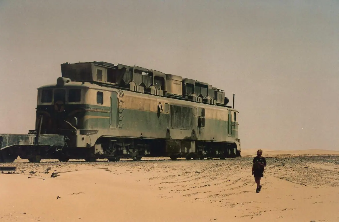
Stay in Mauritania
Hotels, guesthouses and apartments — compared in one search.
Search hotels
Transfer in Mauritania
Private driver waiting on arrival — no queues, no surprises.
Book a transfer
Stay online in Mauritania
Travel eSIM — data the moment you land, no roaming bills.
Get an eSIM