The Marshall Islands is a country drawn in thin lines of coral and bright water — 29 atolls and five solitary islands scattered across a swath of the central Pacific so wide that the lagoon inside a single reef can hold an entire city. Come for the wrecks, the flats, the outrigger canoes and the unhurried outer-island life; stay for the sense that you have arrived somewhere genuinely far away.
Majuro: Capital Atoll Landmarks and Lagoon Life
Majuro is almost everyone's first impression of the country, and it is a strange, wonderful one: a ribbon of coral barely a few hundred metres wide at its narrowest, threaded by a single road that runs from the western tip at Laura all the way east to Djarrit. The capital districts — Delap, Uliga and Djarrit — hold the government, the harbour, the shops and most of the beds, all pressed between the calm turquoise lagoon on one side and the white surf of the outer reef on the other. The Marshall Islands Capitol in Delap is the country's most recognisable building, with its tiered roof and lagoon-side lawn, and it is worth a look on the way past.
In Uliga, the Alele Museum, Library and National Archives is the single best introduction to the country: shell tools, woven mats, Second World War photographs and the famous mattang stick charts, in which palm ribs and shell beads map the swell patterns between islands — a navigation system built entirely without instruments. A short drive east near the airport, the Japanese Peace Park is a quiet memorial garden with a stone monument and a Japanese-style bridge commemorating those who died in the Pacific campaign. At the far western end, the road runs out at Laura Village and Laura Beach, the atoll's best swimming and sunset spot, where the lagoon fades from jade to pale blue and rusting wartime concrete still sits in the bush along the ocean side. Driving the length of Majuro takes about an hour; most visitors use it as a base for three or four nights before pushing further out.
Diving and Snorkelling the Atolls: Bikini, Jaluit and Mili
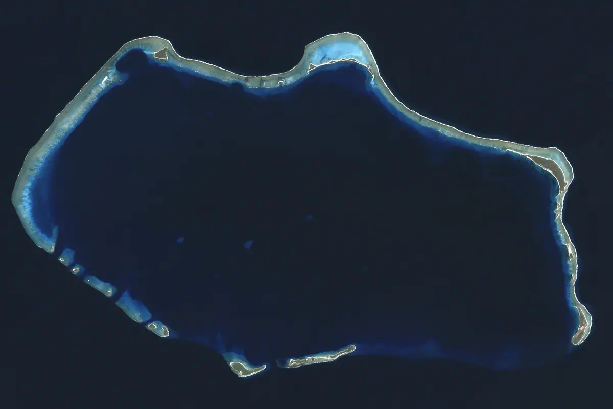
Bikini Atoll is the most extraordinary dive destination in the country and one of the most sobering places on earth. A UNESCO World Heritage Site as the setting of the postwar nuclear tests, its lagoon floor is a graveyard of warships sunk as targets in 1946, including the aircraft carrier USS Saratoga, now furred with coral and patrolled by reef sharks. The Saratoga sits deep — this is diving for experienced, depth-rated divers only — and trips run as liveaboard expeditions, usually staging from Kwajalein during the northern summer, with permits arranged in advance. Nobody lands on Bikini Island itself; the atoll is visited from the water.
Jaluit Atoll, once the German colonial capital of the Marshalls and later a Japanese naval base, is a conservation area on the country's UNESCO tentative list: an enormous lagoon of coral heads, channel drop-offs and wartime wrecks, with manta rays gliding along the pass edges. Mili Atoll is remoter still, its reef shallower and its shore scattered with Japanese seaplane ramps and rusting guns that few outsiders ever see. Closer to the capital, Majuro's own lagoon offers easy half-day snorkelling over coral heads and along the outer reef drop-off, and Arno Atoll lies just across the channel — a short boat ride or a hop by light aircraft to reefs that see almost no divers at all.
Second World War Relics, Above and Below the Water
The Marshall Islands were the hinge of the American push across the central Pacific, and the war is still legible in the landscape. Japanese garrisons held Wotje, Maloelap, Mili and Jaluit, which were bombed relentlessly and then bypassed; Kwajalein was stormed in early 1944 and became a vast forward base. On Wotje and Maloelap you can still walk airfield revetments, bunkers and gun emplacements; on Mili the seaplane ramps survive at the water's edge; in Majuro lagoon there are dropped tanks, anchors and debris on the reef. History-minded travellers often pair a museum visit in Uliga with a slow circuit of the memorial sites on the capital atoll.
The nuclear story is inseparable from the same islands. Bikini and Enewetak hosted the postwar test programme, and on Runit Island at Enewetak the concrete cap known as the Cactus Dome still covers tonnes of contaminated debris. The 1954 Bravo test, which caught islanders and fishermen downwind, is commemorated every 1 March on Nuclear Victims Remembrance Day, when Majuro holds a public ceremony and outrigger canoes carry flowers out onto the lagoon. Access to Enewetak and Bikini is tightly controlled, so for most visitors the museum, the memorials and the March ceremony are how this history is encountered.
Outer Atolls: Likiep, Arno and Traditional Island Life
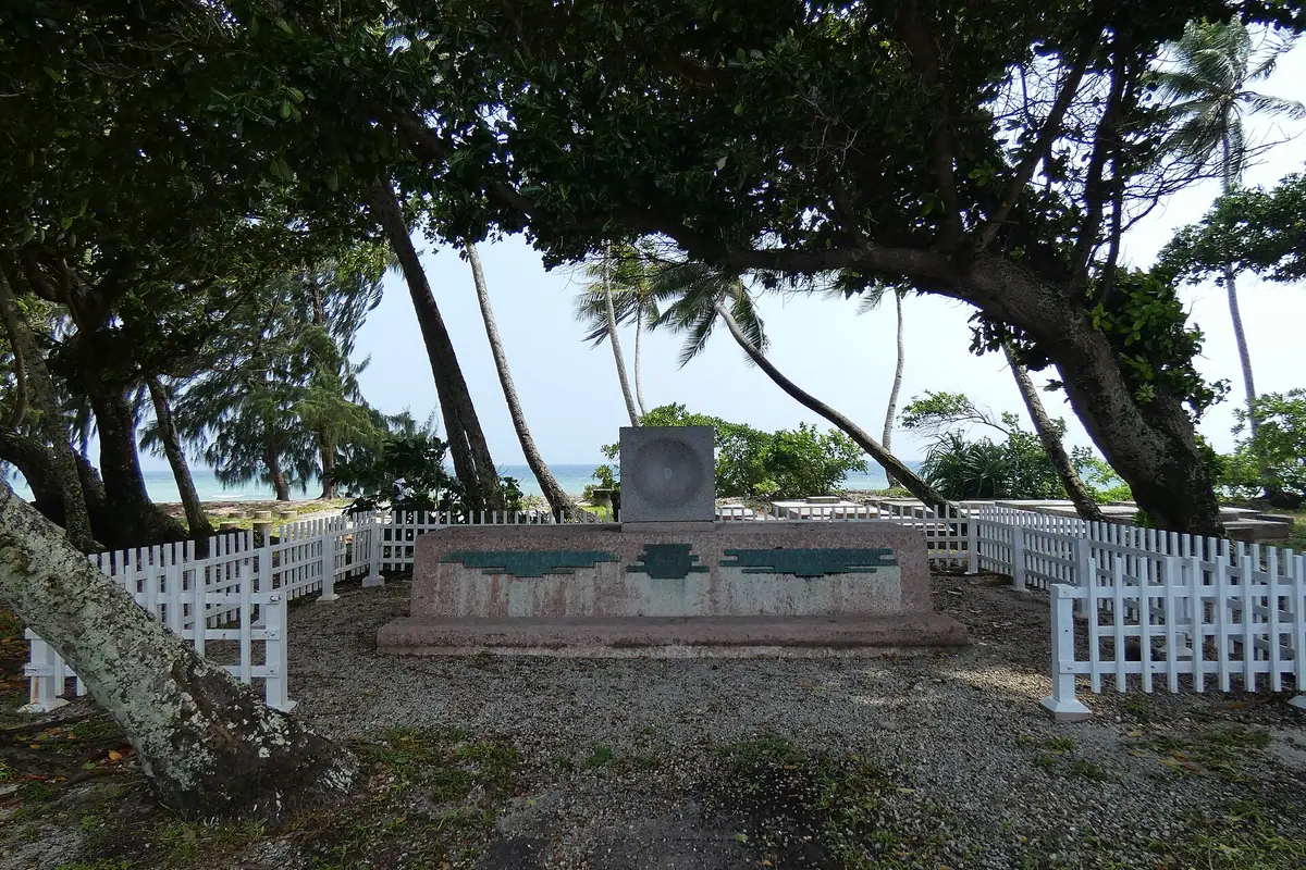
Likiep Atoll is the country's most rewarding heritage detour: a UNESCO tentative-listed collection of 19th-century buildings left by the German trading era, including a Catholic church and coral-stone houses set among coconut plantations, all on a narrow, sleepy atoll far from the capital. Reaching places like Likiep is half the adventure. Small domestic aircraft link Majuro with a handful of outer atolls on tight baggage allowances, while government field-trip ships carry passengers between islands on supply runs — slow, cheap, weather-dependent and utterly absorbing if you have the time and the flexibility.
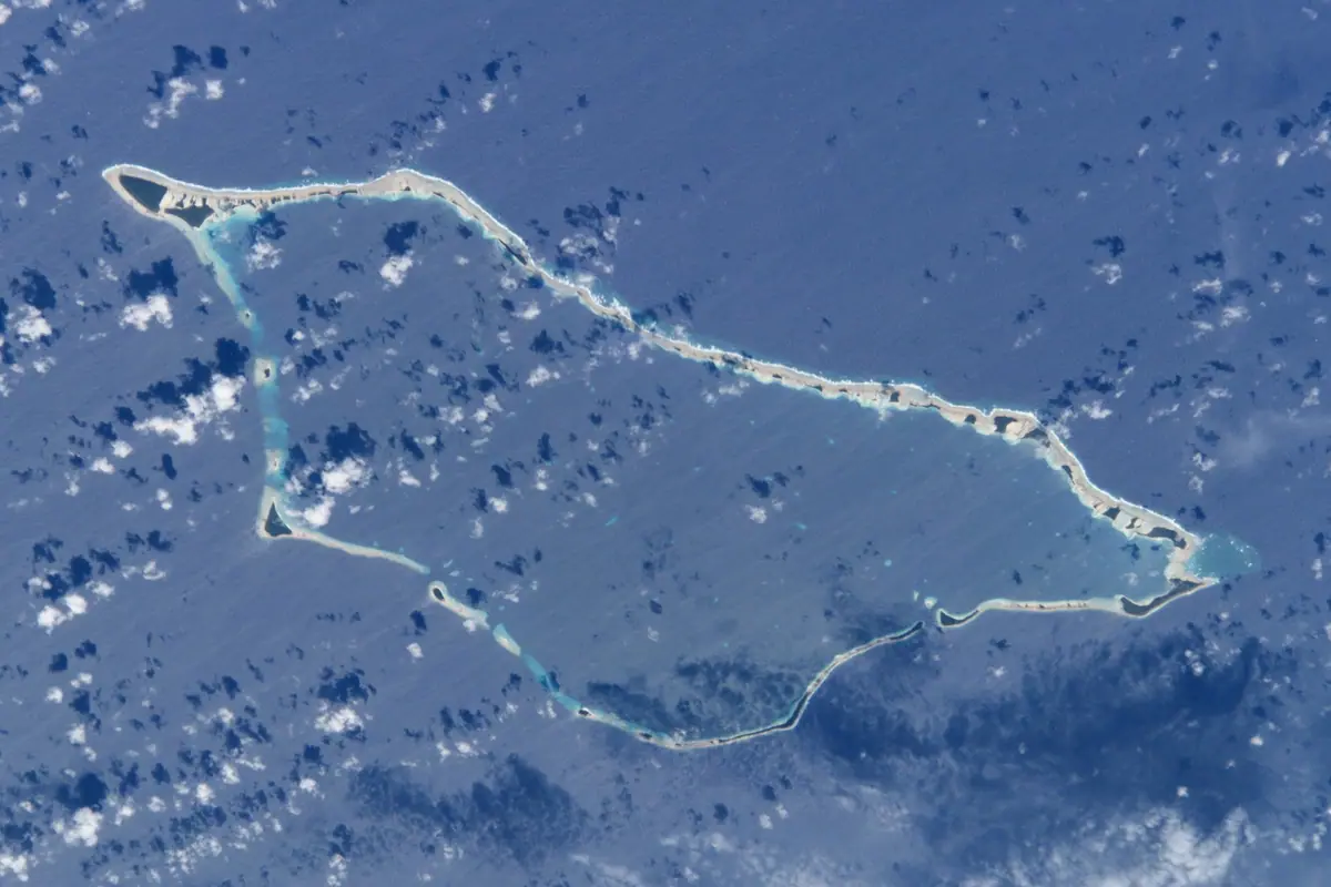
Arno Atoll, an hour or two by boat from Majuro, is the simplest taste of outer-island life: villages with no resorts, fishermen heading out at dawn, and women weaving pandanus on shaded platforms. Traditional skills still sit at the centre of Marshallese identity — the walap, a long voyaging outrigger built plank by plank, and the smaller korkor used for lagoon fishing, plus the fine jaki-ed mats woven from pandanus and the shell jewellery sold in the capital's craft shops. Visitors are warmly received but should dress modestly away from the lagoon, ask before photographing people or homes, and remove shoes before entering a house; English is widely spoken alongside Marshallese, and a few words of greeting go a long way.
Fishing, Paddling and the Water Sports Year
The water is the main event. Offshore, Majuro's small charter fleet targets blue marlin, yellowfin tuna, wahoo and dogtooth tuna, while the pale flats on the lagoon side and around Arno hold bonefish that draw fly anglers from across the Pacific — mostly fished on a catch-and-release basis with local guides. Snorkelling, kayaking and stand-up paddling are all possible straight off the lagoon shore, and the calm water inside the reef makes the country unusually friendly to beginners; sea conditions are steadiest during the trade-wind months from December to April.
Surfers watch the ocean-side reef passes, which light up when north swell arrives between November and March; kiteboarders work the lagoon shallows on windy days. If you can, time a trip around Fishermen's Day in early July, when outrigger canoes race across Majuro lagoon, fishing tournaments run all day and the foreshore fills with food stalls and music. Manit, or Custom Day, in late September is the other big cultural occasion, celebrating weaving, dance and canoe building. Both are superb windows into Marshallese life — and both fill the capital's limited accommodation, so book well ahead.
When to Go and How to Plan an Atoll Trip
The climate is tropical and steady, generally 27–30°C year-round with warm lagoon water and reliable trade winds. December to April is the drier, breezier stretch and the most comfortable time to travel; May to November brings heavier rain, higher humidity and the small risk of a storm, though the Marshalls sit largely outside the main typhoon belt. Flights arrive at Amata Kabua International Airport outside Majuro on the island-hopper routes from Honolulu and Guam, and onward travel to outer atolls uses small aircraft with strict weight limits or seats on government supply ships, which are inexpensive but frequently rescheduled.
Plan around cash: the US dollar is the currency, card acceptance is patchy outside the capital's larger hotels and shops, and ATMs are scarce once you leave Majuro. Most nationalities receive a 90-day tourist permit on arrival with a passport valid for six months and proof of onward travel, and access to Kwajalein — home to a restricted military installation — is not open to casual visitors, though the neighbouring island of Ebeye can be reached by boat. Pack reef-safe sunscreen, reef shoes, a mask and snorkel, a light rain shell, modest clothing for villages and strong mosquito repellent, and reserve inter-atoll flights and any liveaboard berth several months in advance.
Frequently asked questions
What is the best time of year to visit the Marshall Islands?
December to April is the driest and breeziest window, with calm lagoon water and the most comfortable temperatures. May to November is wetter and more humid, though still very warm. Fishermen's Day in early July and Manit (Custom) Day in late September are the two best cultural events, but book accommodation early if you plan around them.
How do you get to the Marshall Islands and around the atolls?
International flights land at Amata Kabua International Airport near Majuro on island-hopper routes from Honolulu and Guam. Between atolls, small domestic aircraft serve a handful of islands with tight baggage allowances, while government field-trip ships carry passengers on supply runs — cheap, slow and subject to weather delays.
Do I need a visa for the Marshall Islands?
Most visitors are issued a 90-day tourist permit on arrival, provided they hold a passport valid for at least six months and proof of onward travel. Entry rules can change, so confirm current requirements before booking, and note that access to Kwajalein is restricted to authorised personnel.
Can you dive Bikini Atoll?
Yes, but only on organised liveaboard expeditions, usually staging from Kwajalein during the northern summer, with permits arranged well in advance. The lagoon holds the wreck of the aircraft carrier USS Saratoga and other test targets at serious depth, so it suits experienced, depth-rated divers. Landing on Bikini Island itself is not permitted.
What should I pack and how should I behave in villages?
Bring reef-safe sunscreen, reef shoes, snorkelling gear, a rain shell, mosquito repellent and modest clothing for outer islands, where swimwear belongs at the beach. Carry cash in US dollars, as ATMs and card payments are limited away from Majuro. Ask before photographing people or homes, and remove your shoes before entering a house.
Plan it — experiences in Marshall Islands
Live search, booked directly with trusted providers.
Sort the rest of your trip
Everything for Marshall Islands, in one place
Stay in Marshall Islands
Hotels, guesthouses and apartments — compared in one search.
Search hotels
Transfer in Marshall Islands
Private driver waiting on arrival — no queues, no surprises.
Book a transfer
Stay online in Marshall Islands
Travel eSIM — data the moment you land, no roaming bills.
Get an eSIM