Nauru is a single coral island the size of a small city, ringed by a reef and crowned by a mined moonscape, reachable only by one of the rarest flights in the Pacific. A week here is not a whirlwind — it is a slow, deliberate loop around the world's smallest island nation, where the runway crosses the main road and every district is minutes from the next.
The Flight In: How You Actually Reach Nauru
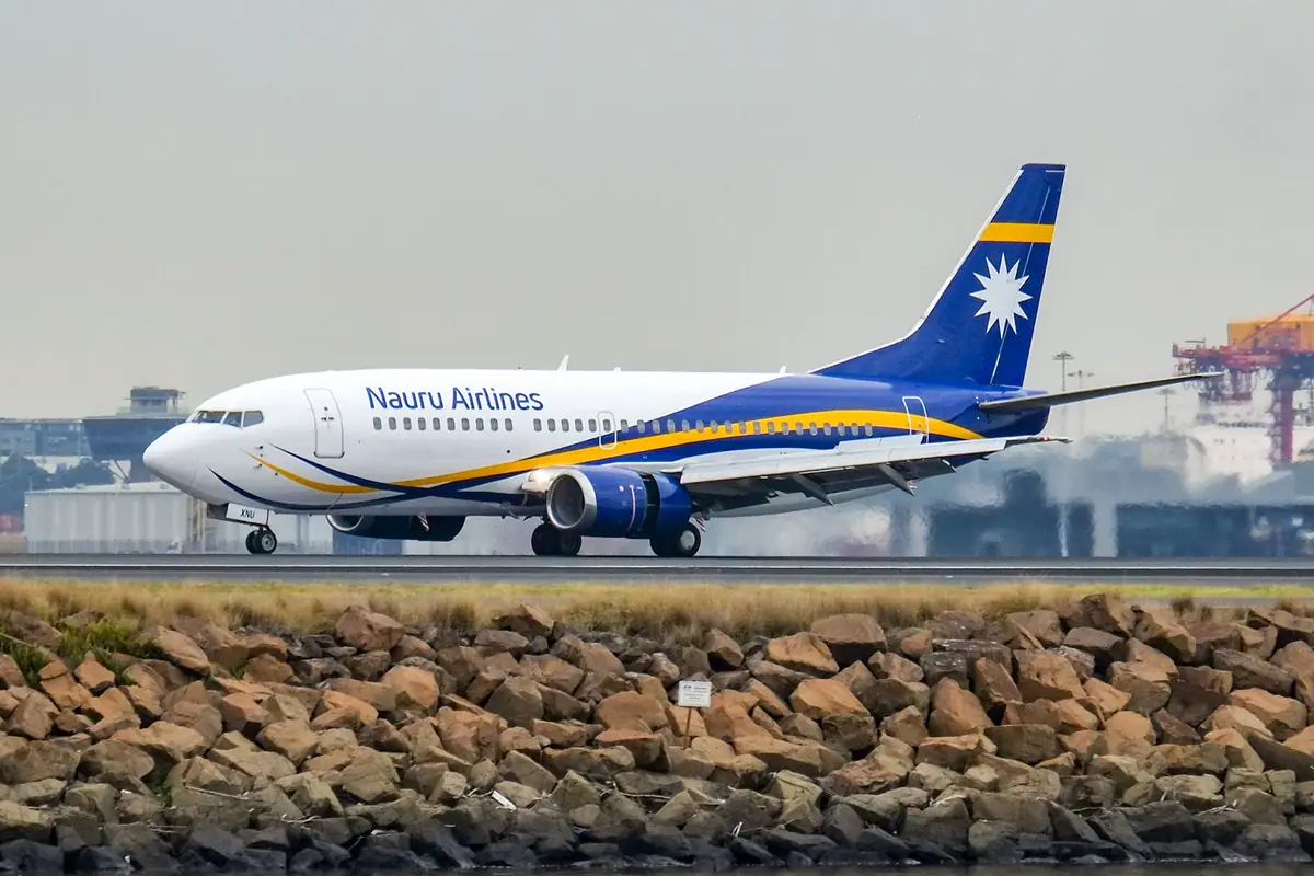
Nauru is reached by air alone. The national carrier's single jet is the island's lifeline, linking it to Brisbane in about four and a half hours on a roughly weekly rotation, with occasional extensions to other Pacific islands. Seats are few and sell out months ahead, and schedules do shift, so build slack into your plans — there is one runway and no alternative route.
Landing at Nauru International Airport in Yaren district is the first surprise: the airstrip slices across the island, and the ring road simply crosses it, with barriers lowered before every movement. Visas are normally arranged in advance with proof of accommodation and onward travel, so sort paperwork early. On the ground there is no useful public transport — hire a car (driving is on the left, Australian-style) or arrange transfers through your guesthouse — and bring Australian dollars in cash, because ATMs are scarce and cards are accepted in only a handful of places. Book your room before your flight: sleeping options are genuinely limited to a few small hotels and guesthouses.
Days 1–2: Yaren, Moqua Well and the Aiwo Cantilever
Start in Yaren, the de facto capital, where the government buildings and Parliament House sit a short stroll from the small national museum, whose displays cover the phosphate industry and the Second World War. Nearby is Moqua Well, a freshwater cave and pool that once supplied the district — cool, dim and easy to miss if you don't know it's there.
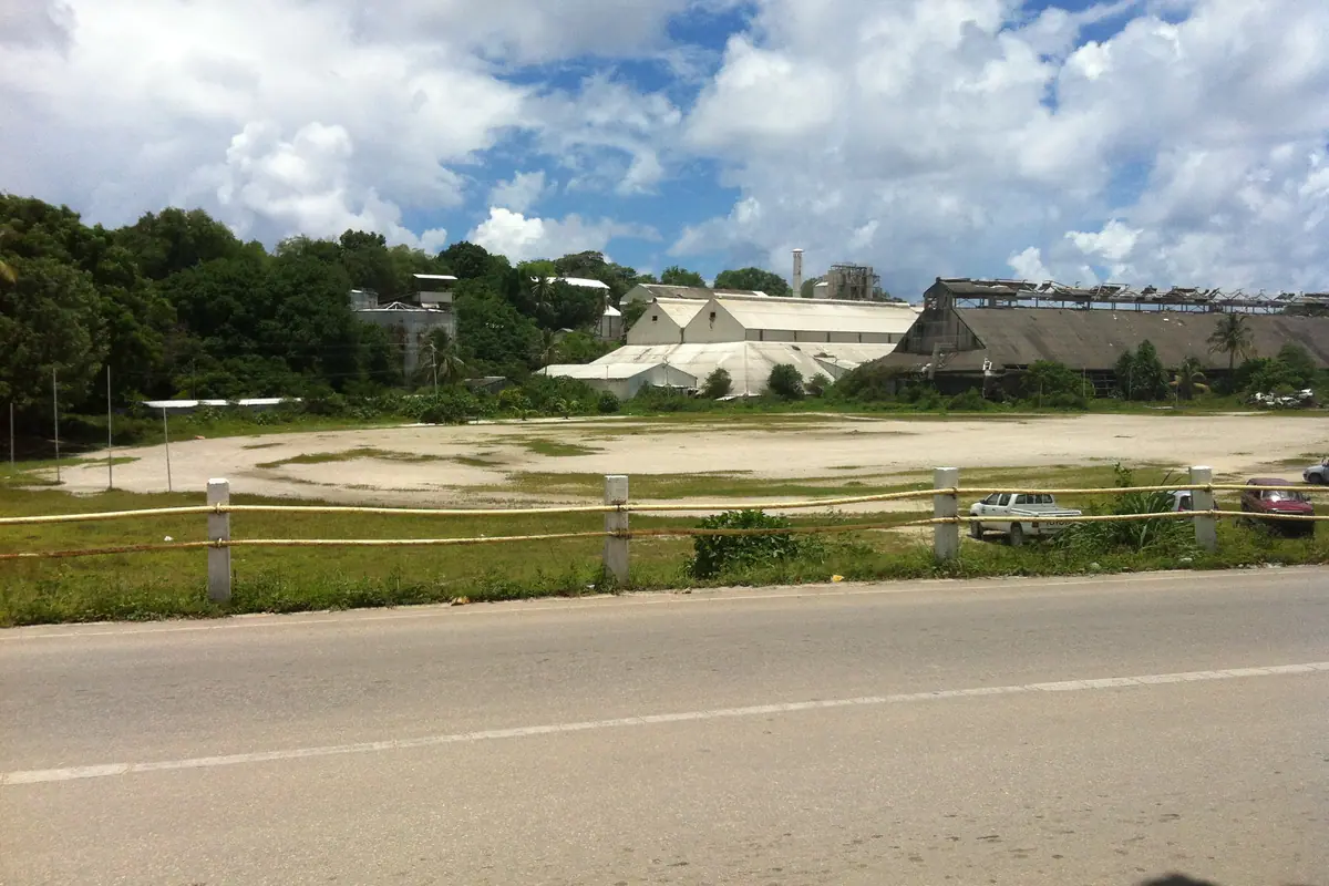
Then head west to Aiwo, where the phosphate story is written in rust and steel. The cantilever, a long loading arm reaching over Aiwo Harbour to tip phosphate into waiting ships, is the island's most striking industrial landmark, with the processing plant still humming behind it. In neighbouring Denigomodu, the old workers' settlement known simply as The Location recalls the boom years.
Finish with sunset on the west coast, where the light drops straight into the reef. Restaurant hours are short, so eat early and keep the pace slow.
Day 3: Command Ridge and the Topside Pinnacles
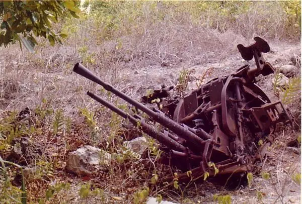
Command Ridge, at roughly 65 metres the island's highest point, is its most compelling historic site: Japanese Second World War gun emplacements, bunkers and coral-cut tunnels and steps. From the top you can see almost the entire country at once — the airstrip, the reef, Buada Lagoon, all 21 square kilometres of it.
Behind the ridge lies Topside, the mined-out interior, now a field of jagged limestone pinnacles. This grey-and-white moonscape upends every expectation of a palm-fringed Pacific island, and it is eerie and photogenic in equal measure, best at first or last light when shadows give the rock depth.
Go early, carry more water than you think you need, and wear closed shoes, because the coral rock is sharp and there is almost no shade. This is also where the war's cost is most visible: Nauruans were deported from their own island during the Japanese occupation, and few returned.
Day 4: Anibare Bay, the Harbour and the Best Swimming
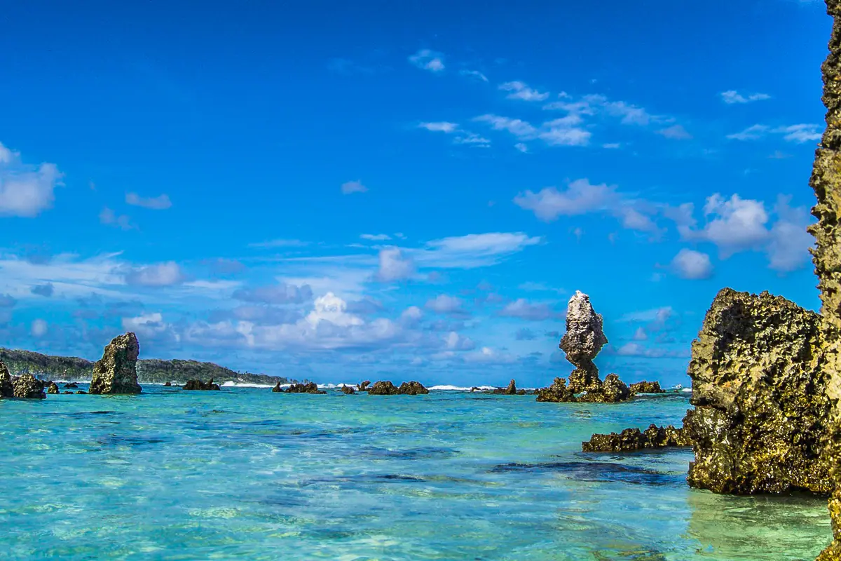
Anibare Bay on the east coast is the island's finest sand — a wide, curving sweep where the fringing reef usually keeps the sea calm enough for swimming and snorkelling. Come in the morning for flat water and good light, and bring reef shoes, since the coral starts close to shore.
At the southern end, Anibare Harbour is a boat basin carved out of the reef, where fishing boats come and go and locals swim off the ramp in the afternoon. It is the simplest place on the island to eat genuinely fresh tuna.
Follow the coast north towards Anabar, past wartime remnants including the remains of a Japanese seaplane ramp. Noddy terns wheel over the reef edge and frigatebirds ride the thermals above the flats; if someone offers to take you fishing, say yes.
Day 5: Buada Lagoon and the Green Interior
Buada Lagoon is the island's only substantial body of water — brackish, palm-ringed and startlingly green, set among pandanus, breadfruit and coconut. A few minutes from the bare pinnacles of Topside, it feels like a different island entirely.
Walk the rim slowly. This is the best place to look for the Nauru reed warbler, the country's only endemic land bird, along with noddies and terns nesting in the surrounding trees. Gardens, taro patches and pigs mark the lagoon's edges as a working landscape rather than a park.
Water is precious on an island with no rivers, reliant on rain tanks and desalination, so carry a refillable bottle and top it up wherever you are staying.
Days 6–7: The Ring Road, Island Life and Flying Out
The ring road circles roughly 19 kilometres through all of Nauru's districts — Yaren, Boe, Anabar, Anibare, Meneng, Buada, Aiwo, Denigomodu, Nibok, Uaboe, Baiti, Ewa and Anetan. Drive it in half an hour, or walk or cycle it over a full day and you will pass schools, churches, the football oval, the cemetery and every little shop on the island.
Weekends belong to sport. Australian Rules football pulls a crowd, and weightlifting is close to a national obsession. Sit in the shade and watch a match and you will meet more locals than in a week of sightseeing.
Eat what is local and fresh — tuna, coconut, breadfruit, pandanus — and expect most everything else to arrive imported, at import prices, paid in cash. On departure day, check in early: the terminal only comes alive around the flight, the road over the runway closes before it, and when the aircraft goes, that is it until the next one.
Frequently asked questions
How do you get to Nauru?
By air only — there are no passenger ferries. The national carrier operates the island's single runway, with a roughly weekly service to Brisbane and occasional extensions to other Pacific islands. Seats are limited, so book well ahead and stay flexible about dates.
Is one week too long for Nauru?
Not if you want slow travel. You can comfortably cover every district, both coasts and the interior in a week, with time left for snorkelling, fishing, birdwatching and the Second World War sites. Anyone chasing a packed sightseeing schedule would find three or four days enough.
When is the best time to visit?
It is hot and humid year-round, typically 27–32°C. The drier, breezier months from roughly May to October are the most comfortable for walking and hiking. November to February brings heavy downpours and the island's wet-season storms.
Do I need to bring cash?
Yes. The currency is the Australian dollar, ATMs are few and unreliable, and card acceptance is limited to a couple of larger businesses. Bring enough cash to cover your whole stay, including meals and transport.
What should I pack for Nauru?
Light, loose clothing, reef shoes, a hat, strong sunscreen, insect repellent, a refillable water bottle, Australian-style plug adapters for 240V sockets, and any medication you rely on — supplies on the island are limited and restocking is not quick.